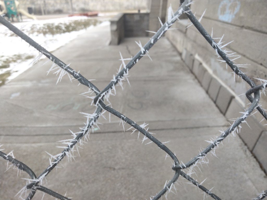
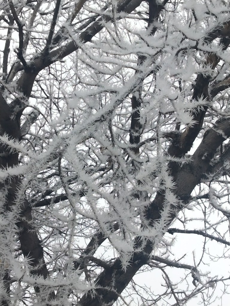
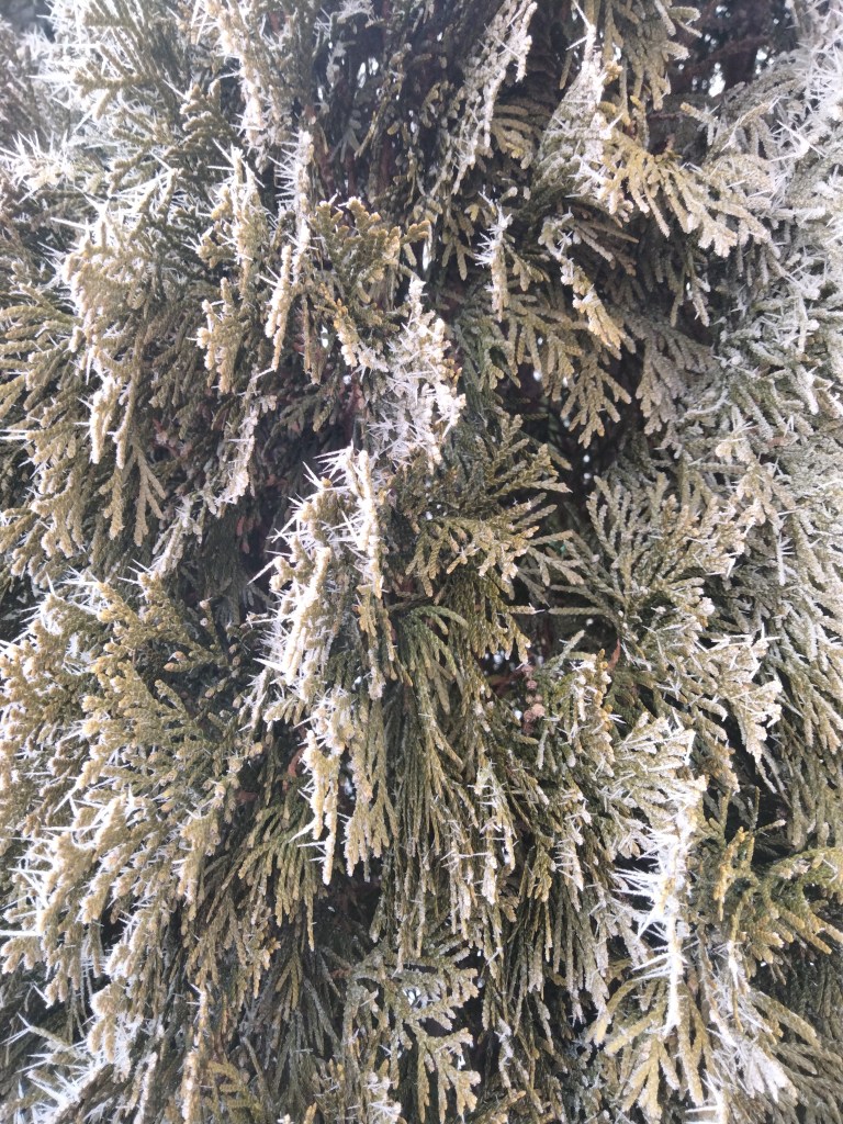
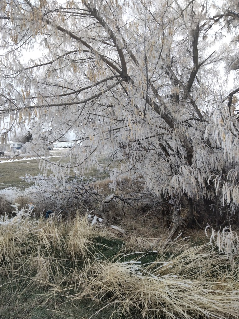
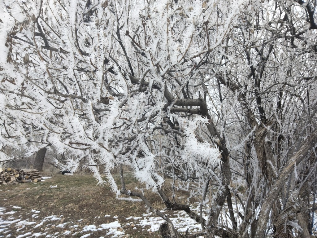
The Trove, American Falls, Idaho

American Falls, Idaho, is the ultimate American Small Town.

What do I mean by Small Town?: a brief parenthesis

For those who are not American–by which I mean the United States–“small town” doesn’t have quite the same connotations as “village.” A “village” sounds older, like it might have been there for a thousand years, whereas a small town, because it’s in America, is no more than 300 and often only 100 years old. “Village” also sounds more homogenous (is everyone related?), and more rural. A village might have feuds and unspoken rules in it that go back a millennium. A small town, while it is getting a start on these things, is basically a recent, frontier development. Though there are founding families, there’s also a lot more movement. City folk come in, start businesses, or get jobs as teachers. Newcomers arrive from other small towns. Children grow up and leave. Americans are very mobile, and the composition and atmosphere of a small town reflects that. There isn’t as rigid a class system as in most other places. And, though American Falls, for example, is the county seat, there’s also a lot less bureaucracy and fewer government jobs than in a town of comparable size in Asia.

On the other hand, a “small town” is definitely not the same as “hood” (short for neighborhood), which is a village-like section of a large city. Small towns are typically located in farmland.

Anyway. American Falls has the following: a river. A hydroelectric dam. A railroad to take farm produce away to be sold. A lot with silos, trucks, and piles of produce near where this railroad passes through town. Lots of churches. Post office, barber shop, mom & pop shops on Main Street (tree-lined), one of which is of course a bar. A hometown football team. Gracious parks, a golf course, and a nearby cattle lot that you can smell most days. Pizza, Chinese, and Mexican restaurants, because this is America after all. It also has a small hospital, though like most people I prefer to take emergencies to the city hospital 25 minutes down the road. Oh, and a community theater!

You can walk around American Falls during the day without fear. Law and order is maintained. The town is hilly enough that, on these walks, you can catch glimpses of all these small-town features and feel as if you just stepped into a slightly more modern, drastically less New England Norman Rockwell painting. Rising above the town, on the southwest side, is the Big State Highway, and, beyond that, the rolling foothills.

I felt I had to burst into this paean to American Falls in order to set the scene for the main point of this post, which is that a delightfully hippie shop has come to our small town.

An Art Shop comes to our Small Town

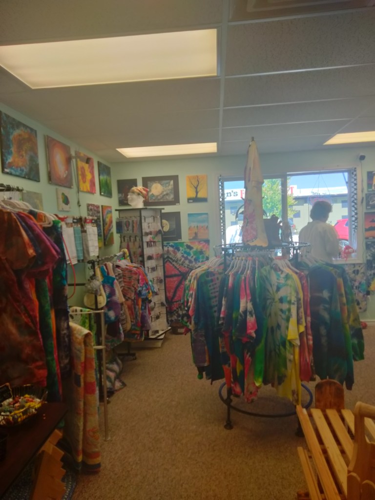
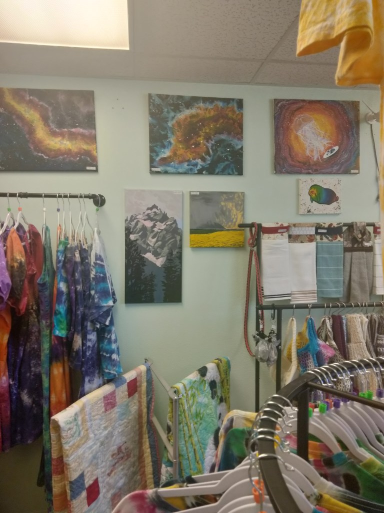
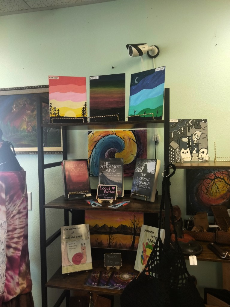
This is the interior of The Trove, which opened in American Falls in May.

Here we are looking towards the back of the shop. Notice that it features jewelry, leather goods, and paintings involving UFOs. And that the owners are fond of 78 records.

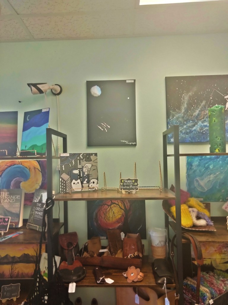
I first heard about The Trove from a person I met at the town festival this summer. This person, who was buying one of my son’s paintings, suggested that The Trove might be happy to carry our work, since its stated mission is to showcase local artists. Although we don’t live actually in American Falls, we figured we might be local enough to count. We headed straight from the town festival to The Trove, with the trunk of our car still full of paintings. Long story short, the owners of The Trove were amenable to this idea, and that’s why some of the paintings pictured above are by my son Andrew.

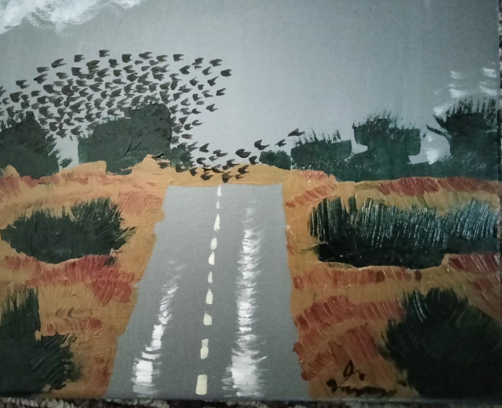
The mountain and the storm are my paintings, hung under the owner’s paintings of space and a (manatee?), over some quilts, and beside dish towels.

The Trove was even happy to carry a copy of my trilogy! So, if you ever find yourself in southeast Idaho, and want a touristy, artsy shop with lots of cool stuff, know that American Falls has one.

Idaho Wildflowers: This Stuff

I photographed this stuff growing, as you see, in/near a stream near the Hiawatha Bike Trail in northern Idaho. N.b.: the taller, thicker plants in the immediate foreground are not the same ones I am talking about. I am focused on the feathery, jointed ones near the stream.

Using my Central Rocky Mountain Wildflowers guidebook and the Internet, here is a list of possible identifications I considered:

  • star gentian
  • red mountain heather or yellow mountain heather. One problem with these two is they seem to prefer dry, sunny spots. Another problem is that their leaves are likely too thick to match.
  • swamp laurel. This is still a good candidate, as it prefers wet spots and, though native to eastern North America, also is said to live in “Montana.”
  • perhaps the young version of some variety of Indian Paintbrush plant. The problem, again, is that they seem to prefer dry, sunny areas.
  • rough wallflower. Problem: “found on open, lightly wooded slopes.”

Then I broke down and asked Google to examine the photo, which means, like it or not, I was enlisting the help of AI. Here were Google’s two suggestions:

Bassia scoparia is our best candidate, and here’s why. It can be found in “riparian areas,” according to the article that I linked. “It naturalizes and self-seed easily.” “This plant is a noxious weed in several states.”

Edit: Beth has suggested it may be “horsetail,” Equisetum arvense. I looked it up, and Horsetail is the most likely candidate yet! According to Wikipedia,

Equisetum arvense, the field horsetail or common horsetail, is an herbaceous perennial plant in the Equisetidae (horsetails) sub-class, native throughout the arctic and temperate regions of the Northern Hemisphere.  … Many species of horsetail have been described and subsequently synonymized with E. arvense. One of these is E. calderi, a small form described from Arctic North America.

https://en.wikipedia.org/wiki/Equisetum_arvense

Northern Idaho isn’t exactly Arctic, but it’s gettin’ close.

The 1917 Mine Disaster in Butte, Montana

When I went to see Sage Wall, we stayed in Butte, Montana (pronounced byoot or biut), which is a relatively short drive from my house by the standards of the American West. Butte is a mining town, once known as “The Richest Hill in the World,” although generally, the riches were being spread thin, not going to the people who actually lived there. The riches are copper, silver, and, I believe, opals. If you have more time than we had, Butte has many things like rock shops and a mining museum. You can see little mining towers dotted all over the landscape.

A view of Butte, looking down from the hill above the town.

This plaque talks about women in Butte when it was a boom mining town. Sadly, Old West boom towns are notorious for having a lot of brothels, and Butte was no exception.

Over the town looms the hill itself, and in this hill is a huge, sandy-colored strip mine known as the “Berkeley Pit.” My husband, being the explorer that he is, wanted to visit the Pit. We got there just after the viewing platform closed, so instead, we drove up into the hills above and behind the Pit so as to get a glimpse into its depths.

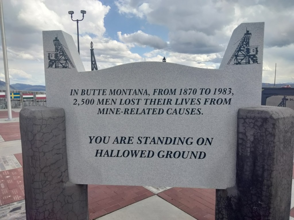
And lo and behold … on a lookout point that overlooks one section of the Pit, we found this monument to fallen miners.

The monument is a large, paved area with the U.S. and Montana flags in the middle, surrounded by a wall on which informational plaques are mounted. I’m going to let my photos of the plaques do most of the work in telling you this story.

The flags you see in the background represent the nationalities of the miners who lost their lives in the disaster.

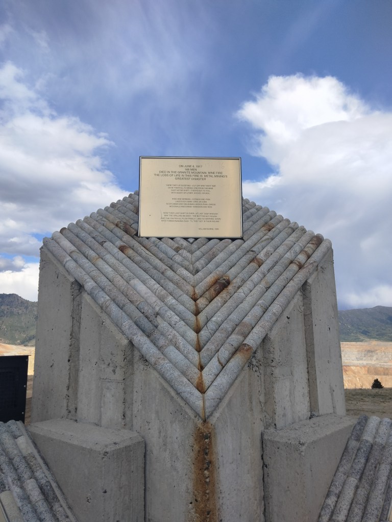
This prominent central plaque gives some basic information about the Granite Mountain Fire in June of 1917. The fire did not take place in the Berkely Pit, but in an underground mine. A cable, which was covered in a paperlike covering, broke and fell down a shaft. A group of miners went down to inspect the damage, and the paper covering on the cable was accidentally caught on fire by one of their headlamps.

This plaque, filled with names of men lost in the fire, is one of several.

The fire quickly filled the mine. Groups of miners, trapped in tunnels, built barricades (“bulkheads”) to protect them from the fire while they awaited rescue. Sealed off like this, their main danger became the limited air supply, plus fear and despair as their food and water ran low and their lamps began to go out.

Some of these men wrote letters to their loved ones. Here is one.

The town of Butte essentially stood vigil for several days. Firemen worked around the clock to put out the fire and rescue miners. Restaurants stayed open and gave meals to the rescue workers. Grocery stores provided for the families of missing miners. People went into churches to pray for their loved ones.

The plaque below describes Butte as “the strongest union town on earth.” My feelings on unions are mixed to say the least, but I can certainly understand the need for them in the early days of mining.

I was Seldom Disappointed with this funny memoir

The following review was posted on GoodReads on June 27.

I love Tony Hillerman’s Navajo police procedurals. A few years ago, I got to travel through Navajo country (Dinetah), which was amazing because for fans of Hillerman it’s like getting to visit Middle Earth. At the Navajo Cultural Center gift shop, they displayed many of Hillerman’s books, and this memoir. I picked it up, but it took me several years to get around to reading it.

Once I did, it went fast because this is a page-turner. Hillerman’s writing is understated and vivid (he started his writing career as a journalist).

It turns out that Hillerman is closer to the age of my grandparents. He grew up in the Dust Bowl during the Depression, fought in the Battle of the Bulge. Quite a lot of the book is devoted to his memories of France during WWII. He was then injured (legs, and eyes), spent some time in the hospital, and was sent home with crutches and an eye patch. He discovered that “Military Intelligence is usually neither.” He doesn’t dwell on it, but he had PTSD before that was a word. Nightmares, unable to keep his breakfast down. He recounts, in the 1950s, seeing a grisly car accident that made the police officer on the scene vomit, but Hillerman stood there unaffected.

Hillerman and his wife also adopted a number of children, and raised a big, happy family.

All of this is related with almost no self-pity, and it’s often very funny.

This book contained less about the Navajo than I expected. I guess Hillerman has poured his learning about them into his novels rather than into his memoir. But by the time the book reached his later years, when the Navajo became a big theme, I was not disappointed about this because the book itself had already been such an entertaining ride.

There is an appendix which lists a number of Hillerman’s books and sketches out the process that led to each one. They presented different kinds of problems that will be reassuringly familiar to other authors.

All in all, Tony Hillerman is a total mensch, a good egg, and it’s been an honor to get to know him.

White Nails and Sho-Ban Casino Mug

Continuing with the “nails and mugs” series, just for fun. It’s these tiny luxuries that make life pleasant.

I got this mug at a local thrift store. I have never gambled at our local casino, but here is its web site.

The Sho-Ban tribal lands are less than an hour’s drive from my house. The Shoshone and Bannock tribes used to have a range that extended farther north, into central Idaho and Montana, as you can verify if you read the book Naya Nuki. They were moved to a smaller place, as has happened to so many tribes. Read this book for a strong argument that American Indians should be treated just like regular American citizens, not as collectivist wards of the state.

Anyway. Although I do not go to the Sho-Ban casino/hotel/event center to gamble, I have been there a number of times. Its banquet halls have hosted our local pro-life banquet for the last several years. Plus, I like to go and eat at their resto (fry bread! bison burgers!) and go to their gift shop. For my last two birthdays, I’ve asked my husband to get me a hand-beaded Sho-Ban item from the gift shop there. These things are not cheap, but boy oh boy, I love them so much. They also smell like woodsmoke when you first buy them.

Here’s a leather barrette beaded in classic Sho-Ban colors.

Apparently, people will come from out of state to play at the Sho-Ban casino. I’ve seen billboards advertising it in Utah, for example. And when my husband and I go and eat at the resto there, the servers assume we are staying at the hotel. I guess we are getting old enough to look the part.

To get from the Sho-Ban event center to our house, you can take the back roads. You can drive through the reservation, over Sage Hill, cross the Snake River, and come out on Highway 39.

It’s a little longer, but it’s prettier and gives a fresh perspective.

Rodeos also take place on the Fort Hall Reservation. I aim to attend one some day. We moved here in 2019, and by the time I realized I ought to attend a rodeo on the rez, they had been cancelled indefinitely because of you-know-what. But I think they are having them again now.

Megalithic Ruins in Montana II: Sage Wall, near Butte

Here I am at Sage Wall, to give you some idea of the scale.

Sage Wall is a possible megalithic site near Butte, Montana. In this post, I am going to thoroughly embarrass my geologist husband by saying that Sage Wall looks manmade to me. But first, how did I come to visit Sage Wall in person?

Getting to Sage Wall

It’s on my bucket list to visit as many archeological sites as a I can, the older the better. Sage Wall was a no-brainer because it’s only a half a day’s drive from my house. It is also a good candidate to visit because looking at photos is kind of ambiguous. To really get a sense of whether it seems manmade or like a natural formation, I felt I had to be there in person.

We drove up into the beautiful Montanan Pioneer Mountains (Idaho has some as well), stayed the night in Butte, and the next day, made our way to Sage Mountain Center, where I had a reservation. We could not have asked for a more beautiful day, weather-wise. Early June in the Butte area is still basically Spring.

Chris and Linda are the property owners at Sage Mountain. About three decades ago, they wanted to move out to the middle of nowhere and build a sustainable house and retreat center. They were not looking for megaliths. Linda stumbled upon the wall on a hike one day, and Chris, who has a background in building, looked at it, said, “Yep. That doesn’t look natural. Well, let’s get back to our projects.” It wasn’t until years later, when they had established a sustainability-themed retreat center and had started to create some hiking trails for their guests, that other people started noticing the wall. Chris and Linda cleared the brush around the wall, roped it off, and had it examined by LIDAR and ground-penetrating radar.

Now, many people are coming to see the wall, seemingly to a point where it is almost becoming a problem. Sage Mountain Center is still on a wind-y, washboard-y dirt road, but now many people, seeking to get away from it all, have built new houses and cabins along that same road. Chris asked us, as we drove out, not to “go too fast past our neighbors. We’re trying not to bother them.” I got the impression that his main desire is still to just run a sustainability B&B in peace, but he’s been saddled with this danged wall.

What Would a Skeptic Say?

I want to give the skeptical geologists their due here. I think what they would say is this: “All these people who are saying Sage Wall is amazing megalithic structure are forgetting one thing: It is right in the middle of the Boulder Batholith! There are big granite rocks everywhere!”

source: formontana.net

They are not wrong. The mountains to the east of Butte, where Sage Mountain Center is located, are strewn with large granite boulders and outcroppings. These tend to fracture into shapes resembling worked blocks of stone.

Here are some pictures I took, on the way in, of natural granite outcroppings so you can see how they normally look and how they tend to fracture:

You can see that the fractures are often horizontal and strikingly block-like.

We also saw some pieces of granite that had very large quartz crystals formed in them, which stuck out like chips in a chocolate chip cookie:

And, just for fun, here’s a balanced rock:

I’m not sure whether this balanced rock is natural, but I’m leaning towards no. I’m thinking it was put there to mark the trail.

Anyway, the skeptics are correct that the presence of big, blocky rocks does not an ancient megalithic structure make. This is part of the reason I wanted to see Sage Wall myself. I did not take any videos of it, because I’m not good with video and didn’t have a script ready. But there are now many videos of Sage Wall online, including drone videos. I’ll try to embed some of them at the end of this post.

Why Sage Wall is Likely Man-Made in my Amateur Opinion

So no, the claim is not that this must be a megalithic structure because it is located somewhere that we would not expect rocks. It is definitely surrounded by rocks. However, it looks distinctly different from the more random rock outcroppings around it.

It is very long, and very straight. (The wall extends past the Sage Mountain Center property, but only their section of it has been cleared.)

Unlike what we see with other fracturing patterns, the wall consist of very big blocks laid out in what appear to be courses. To my (again, amateur) eye, when we see natural fracturing the blocks tend to fracture into smaller pieces where they are exposed.

In the pictures above (and in the one where I’m posing), you can see a hollow lower down in the wall where a block obviously fell out.

At three different places in the exposed section of the wall, there are gaps in the top similar to doors. Chris told us there had been a lot of speculation about these before researchers realized that they were simply places where boulders had fallen out. In fact, you can see the boulders below them, almost completely buried in dirt and pine duff.

On the picture above, you can also see the remains of a triangular shape. The left side of the triangle is made with shaped blocks, and the right side is incised into the megalith. The triangle happens to frame the gap where a block fell out.

According to Chris, the geophysicist who examined the wall with ground-penetrating radar found that it goes down into the ground about another 20 feet. At the bottom was something that reflected the radar, as it might be a floor or stone foundation.

All of this research is shortly to be posted on the wall’s website, here or possibly here.

Parallel to the wall are the fallen remains of what appears to be another wall. You can see that it is “fractured” in the same way, and these other blocks also have some of the nub and cup features that we’ll talk about below.

Here’s a bit of the second wall, seen end-on.

Behind the Wall

Here’ a view behind the more intact wall. Chris and Linda have installed a rope that allows visitors to climb up behind the wall. As you can see, the wall is not just part of a cliffside, but it does have earth and rocks filled in behind, either as terraces/a retaining wall, or the ravages of time.

From behind the wall, we look out through a gap left by a fallen stone across the avenue at the remains of the second wall.

Getting close to the top of the wall allows us to see what might be nubs and cups.

Nubs and Cups

Stone nubs and cups (not necessarily corresponding to each other) are sometimes features of megalithic architecture in other parts of the world.

“Cup and ring” markings are apparently found all over the world, but especially in Northern Europe. Here are two articles about them.

Stone nubs or knobs are also found, especially in Incan or pre-Incan megalithic architecture.

Here are some nubs found on top of the intact wall.

They are not the same as the pieces of quartz sticking out of the natural stone that we photographed earlier.

Because the wall is so weathered, some of them are not certain.

Note the possible incised lines above this last nub.

Here are some other things we saw on the back of the wall:

Incised straight line

Suspiciously square fracture line

On the fallen wall as well, we found some things that look like nubs, and some possible cups. As a nod to the skeptics, yes, these “cups” do look like they could have been caused by water erosion. This would be especially true if they were found under a waterfall or a persistent drip, which they are not, as far as I can see. Some of them are also suspiciously round.

Very round “cup” in which someone has placed some fresh lichen

Some also have very straight lines incised near them. My son suggested they could be a water feature.

Looks like a cup with a spout

False Nub Alarm? Or Another Part of the Complex?

As we hiked away from Sage Wall, I took care to photograph natural rock formations for comparison. Not very far from the walls, I saw something that also looked like nubs.

Did this mean that such nubs are a natural feature of the way granite weathers? Or could this be another part of the same complex as the wall? The formation on which I spotted these nubs certainly looks like the remains of a constructed passage.

A Post-Flood Megalithic Culture

After I left Sage Wall, my husband asked, humoring me, what I thought its purpose had been. My answer is that I have no idea. It is way too old, weathered, and partially buried for me to speculate. (This does not bother Julie Ryder over at Montana Megaliths, so if you want to see some people speculate very confidently, you can visit there.)

What I can say is that, granted this is not a natural formation, it most reminds me of Sacsahuayman and other sites in Peru. You have the same dry stone construction with megalithic blocks that are shaped, but are not in uniform sizes or in a regular pattern. And, of course, you have the nubs. As for scale, it appears that if Sage Wall were excavated down to its foundation, it would be thirty or forty feet high.

Another similarity is that both Sage Wall and the Incan or pre-Incan complexes are built at very high elevations (the Continental Divide runs near Butte).

This suggests to me that they partake of the same culture area.

Sage Wall, of course, has been abandoned much longer than any of the impressive Incan complexes, some of which Europeans got to witness still in use. Consequently, it’s much more weathered, run down, and filled in. But it looks like the same sort of thing.

So, it appears that Sage Wall and any other structures we might find in association with it were built by a group of people who knew how to build with megaliths, and who then had to abandon this site for some reason. It was before recorded history in North America, but that doesn’t mean it was before recorded history was happening elsewhere. Then, they or their descendants or people who partook of the same megalithic culture, moved on towards South America and continued their building there.

I believe there is plenty of evidence–not from Sage Wall, but from other sources–that human dispersion happened very quickly after the Flood, and that when people spread out, they took a megalithic culture with them. Dolmens, pyramids, cities, and inexplicable megaliths have been discovered all over the world. In many cases, as with the Bosnian pyramids, they have been abandoned for so long that they are not immediately recognizable as the work of human hands. You have to know what you are looking at before you can see it. The Bosnian pyramids, first thought to be extremely regular hills, were confirmed as artifacts only when a team dug into them and found tunnels. It looks like something similar happened with Sage Wall.

Immediately after the Flood, the earth would have entered an Ice Age. The climate was in a tailspin: temperatures were low, precipitation at an all-time high. Much of that precipitation quickly got locked up in glaciers. Sea levels fell around the newly configured continents. There were land bridges all over: in Beringia, in Doggerland, in Sundaland. People took advantage of all this newly revealed, very humid land and scattered. But the Ice Age was short, and as glaciers melted, there were sudden catastrophic local floods. People had to abandon their sites. Many of their cities, camps, and settlements are now hidden under water along our coasts. In some cases, such as Gobeklitepe and the Vinca cities, they burned, buried, or otherwise destroyed their sites before moving on. Some of these sites might have been built very quickly and inhabited for only a short time before they were abandoned. Other things being equal, archaeologists tend to overestimate how long it took to build something, and how long ago it appeared. But even very recent sites can be quite mysterious. They have had trouble re-constructing Woodstock, for example.

How Did They Build It?

I don’t know. Obviously they were purty smart. Probably an argument is going to be made that Sage Wall must be a natural formation because “we know” that people in the Stone Age didn’t have the ability to make things like this, despite constant evidence being discovered to the contrary. Or they will argue that “we know” that there were no advanced civilizations in North America, despite Sage Wall itself. Such arguments tend to be self-re-enforcing.

I do know that we do not, currently, have the ability to build with megaliths … at least, not so easily that we consider them our first choice in building material. We might make a monument or a gravestone, but we wouldn’t attempt to build an entire house or city out of megaliths. The effort would just not be worth it. This suggests that the ancients may have had ways that were easier than our current methods.

It is worth noting that there is a well-established oral tradition of giants living in North America. There have also been giant skeletons discovered. In Peru, meanwhile, there is the tradition of the Viracochas, bearded, godlike culture-bringers. No, I’m not suggesting aliens. I do think we should take a closer look at the worldwide oral traditions of apocalypses, floods, gods, and giants, and that we should pay attention to myths that suggest that civilizations were “advanced” right from the beginning. If you want to dig into this more than you already have (and if you are reading this, I assume you already have!), please feel free to look at my page The Research Behind the Books for a suggested reading list.

Embedded YouTube Video about Sage Wall