Graham Hancock’s Big Idea

Photo by Ylanite Koppens on Pexels.com

In this post I attempt to summarize Graham Hancock’s book Fingerprints of the Gods: The Evidence of Earth’s Lost Civilization (1995). This book influenced the background for my novels. It also, in my mind, dovetails with Douglas Van Dorn’s biblical/archaeological research on giants in ways that I am sure Hancock never intended or imagined.

This post is only a summary. It will naturally be much less convincing than the book itself. My copy of Fingerprints runs 578 pages counting the bibliography and index. Hancock builds up to his thesis slowly, presenting many different lines of evidence and dropping mysterious hints to keep the reader intrigued. He also has to get into some fairly technical topics, particularly when talking about astronomy. I can’t do any of that in a 1,000-word post. So, like a bucket of cold water in the face, you will be treated to Hancock’s thesis in all its bizarre and fascinating glory.

Incredibly Sophisticated, Incredibly Ancient Maps

Hancock’s first two chapters are dedicated to the details of a number of old maps drawn up during the 1500s which show parts of South America that were undiscovered by Europeans at that time. More intriguingly, they show the coast of Antarctica as it appears under the ice. (This was before modern man’s discovery of Antarctica, and before seismic surveys revealed what lay beneath the ice.) The best-known of these is the Piri Reis map (drawn up in A.D. 1513), but there are others, such as the Orontes Finaeus map, the Mercator map, and the Buache map. All these mapmakers drew on older maps, which they compiled. Piri Reis, for example, had access to the Imperial Library at Constantinople, which is probably where he got the sources for his map.

The other amazing thing about these old maps is they often show locations in South America, for example, at accurate longitude and latitude.

The lesson that Hancock draws from these maps is this. Whatever source maps Piri Reis and others used, must themselves have been drawn up by an advanced seafaring civilization that had explored the world and knew how to project longitude and latitude. Amazingly, these seafarer/mathematicians apparently charted Antarctica at a time when it was not yet completely covered in ice. That makes their civilization, how do you say? Very, very old.

Ancient Astronomer/Engineers Again

Hancock then turns to the sophisticated ancient buildings that have baffled us in previous posts. He dedicates ten chapters to the Incan and pre-Incan civilization: the Nazca Lines, the amazing complex at Lake Titicaca, and the tradition that connects these to a bearded culture-bringer (the Viracocha), who came from over the sea.

Eleven more chapters describe the Central American cultures: their obsession with numbers, with calculating exact dates in the distant past and future, with forestalling the apocalypse (including by human sacrifice). They were also sophisticated astronomers. The pyramid complex at Teotihuacan, for example, appears to have been laid out as a scale model of the solar system.

And then there is ancient Egypt. Seventeen chapters are dedicated to it. There are many things to notice. Here are just a few: ancient Egyptian civilization seems to have appeared suddenly as a high civilization, complete with myths, history, engineering, and an obsession with boats. Overall, its history is one of slow decline and loss of knowledge, rather than slow buildup. (Interestingly, the same point has been made about ancient Sumer.)  

The pyramids at Giza do not match the pyramids that are supposed to have been built immediately before and immediately after them. They are far more durable and sophisticated than these others. If we accept the received chronology, the Egyptians built some relatively crummy pyramids, then a few generations later built some amazingly good ones, then turned around and went back to building relatively low-quality pyramids again. Hancock suggests that instead, the Giza pyramids are much older than commonly thought. They were built with knowledge or technology that was subsequently lost. The comparatively crummy pyramids are attempts to copy the ones at Giza.

Hancock writes, “Robert Bauval’s evidence showed that the three pyramids [at Giza] were an unbelievably precise terrestrial map of the three stars of Orion’s belt, accurately reflecting the angles between each of them and even (by their respective sizes) providing some indication of their individual magnitudes. Moreover, this map extended outwards to the north and south to encompass several other structures on the Giza plateau … the Giza monuments were so arranged as to provide a picture of the skies … as they had looked – and only as they had looked – around the year 10,450 BC.” (page 356)

The Great Pyramid at Giza has a ratio of 2pi between its original height and the circumference of its base. This strengthens the argument that it was meant to represent a star (a circle). The Pyramid of the Sun at Teotihuacan has a ratio of 4pi between height and base circumference. Both of these pyramids had to have an odd angle of slope to accomplish this (52 degrees for Giza; 43.5 degrees for Teotihuacan), so it seems to have been intentional. Pi was supposedly not calculated correctly until it was done by Archimedes in the third century BC, but apparently the ancient Egyptians and the ancient Mexicans were familiar with it.

Where Hancock is going with all this is that people on both sides of the Atlantic got their amazing engineering, mathematical, and astronomical knowledge from an older “source” civilization. He thinks it was the same seafaring civilization that apparently charted Antarctica. This impression is strengthened by the Egyptian obsession with boats and by the Incan legends that say all this knowledge came from over the sea.

Is Hancock Arguing for Aliens?

Not in this book.

He has written several books about ancient mysteries. I have not read them all. He has now started writing fiction, and in the one novel of his that I have read, it becomes apparent that his interest in all this is decidedly New Age in character. The novel features an angelic/earth mother spirit guide, telepathic Neanderthals, the whole nine yards. So, I can’t swear that aliens won’t show up at some point. But that is not the thesis of Fingerprints.  Hancock is arguing that there was a very advanced civilization of people well before 10,000 BC. Whether these people were taught by aliens, spirits, or some other stuff like that, he does not say, thankfully. Because, luckily, this book relies heavily on evidence.

So the ancient cartographers were not aliens, not even according to Hancock. But still we have a problem: Where was this civilization located? You don’t normally get an advanced civilization until you have a critical mass of arable land. In short, a continent. Hancock believes he has solved this problem. He believes there was such a mass of land, but that it has since undergone a cataclysm. And now we come to the really wild part of his thesis.

It’s the End of the World As They Knew It

Mythology about a period of cataclysms in ancient times is universal. Hancock dedicates four chapters to this alone. Flood myths, for example, are very common. But most cultures also record things like earthquakes, fire falling from the sky, the sun not rising for some long period of time, or an endless winter. Hancock discusses myths like this in some detail from the following cultures: Aztec, Sumerian, Greek, Inuit, Chinese, Southeast Asian, Pacific, Indian, Egyptian, Mayan, and Norse. It should not be hard for the reader to track down these myths. Some cultures (the Aztecs and the Hopi, for example) believe that disasters come at regular intervals and that each one ushers in a new age of the world.

Hancock believes that these myths are actually historical records (with all the usual caveats about them becoming garbled, etc.) of a period of geologic upheaval that happened within human history. I’ll put it in his own words:

“This geological theory was formulated by Professor Charles Hapgood and supported by Albert Einstein. What it suggests is a complete slippage of our planet’s thirty-mile-thick lithosphere over its nearly 8000-mile-thick central core, forcing large parts of the western hemisphere southward towards the equator and thence to the Antarctic Circle. This movement is not seen as taking place along a due north-south meridian but on a swivelling course – pivoting, as it were, around the central plains of what is now the United States. The result is that the north-eastern segment of North America (in which the North Pole was formerly located in Hudson’s Bay) was dragged southwards out of the Arctic Circle along with large parts of Siberia [which were dragged into the Arctic Circle].

“In the southern hemisphere, Hapgood’s model shows the landmass that we now call Antarctica, much of which was previously at temperate or even warm latitudes, being shifted in its entirety inside the Antarctic Circle. The overall movement is seen as having been in the region of 30 degrees (approximately 2000 miles) and as having been concentrated, in the main, between the years 14,500 BC and 12,500 BC – but with massive aftershocks on a planetary scale continuing at widely-separated intervals down to about 9500 BC.” (page 471)

So that’s the thesis. Here are the things it explains:

  • Why North America was once covered with glaciers, centered around Hudson Bay, and why they suddenly started melting.
  • Why, during the same period of time, Siberia was apparently not covered in glaciers
  • Why there is evidence that the climate was once much warmer in parts of Siberia. We find flash-frozen mammoths with temperate or even tropical plants still in their mouths and stomachs. (Actually, I still don’t understand how mammoths could be flash-frozen even with Hancock’s thesis. But at least it offers some explanation.)
  • Why there is evidence that the climate was once much warmer in Antarctica as well.

Furthermore:

  • According to Hancock’s theory, the survivors of this advanced civilization that previously existed on what is now Antarctica fled their homeland, taking their science with them.
  • They settled in other parts of the world and tried to rebuild.
  • Hancock also thinks that they deliberately seeded myths and cults to preserve knowledge and to draw people’s attention to the processional cycle of the constellations because they wanted to warn them. They believed that geological disasters like this occurred cyclically in concert with celestial events. He believes this is why the pyramids were built, for example. A good chunk of his book is about this, but I don’t have time to relate it here.

What’s a Christian Writer to Do With All This?

First of all, it is not possible to integrate everything. It just isn’t.

To take just one example from above, if the earth’s crust took 2,000 years to slip, how did mammoths come to be flash frozen? I have no idea. I don’t think anybody does, whatever their theory.

To take another example, Hancock’s thesis requires that after the age of cataclysms, there were human survivors in scattered parts of the world. These were then visited by refugees from the mother civilization, who taught them things, and they remember these culture-bringers in their mythology. You cannot make this work perfectly with the idea that at one point there was a universal flood that wiped out all humankind except four couples, and that the flood myths are memories of that.  

Every culture has stories of culture-bringers (human or divine) who taught them to do things that are basic to that culture. Most cultures with a flood myth have the survivors of the flood landing right in that culture’s homeland and becoming the direct ancestors of that culture. Most of them don’t have a section in there where the survivors land somewhere very far away, and then their descendants travel a really long way to get to the current homeland. Most peoples believe that they live at the mythic center of the world. So you have to take these things into account. Every origin myth cannot be true in all its details.

That said, here is what I, as a Christian, have attempted to do with Hancock’s thesis and more importantly with the evidence that inspired it.

What I appreciate about Hancock is his attempt to take seriously the many lines of evidence that human beings were familiar with advanced mathematics, engineering, and astronomy long ages before we are told that human civilization started. This fits in, far better than the received “cave man” picture, with the ancient world as it is hinted at in the early chapters of Genesis. There we see civilization taking off like rocket, apparently with writing and record-keeping, and flourishing until it is destroyed by the flood.

Hancock’s theory of earth crust slippage does not contradict the Genesis account either. It is not hard to imagine an age of cataclysms leading up to the great flood. We are not told that this happened, but then Genesis, with its laser focus on redemptive history, does not tell us a great many of the things we would like to know. If we imagine earth crust slippage culminating in a worldwide flood, we end up with almost the same picture as that painted in Fingerprints. The only difference is that the amazing monuments at Giza and other places could not have been built by refugees from a mother civilization. They would have to have been built by Noah’s descendants trying to recover lost knowledge … or by the almost-unknown-to-us civilizations before the flood.

Genesis: Even More Daring than Hancock

Genesis does not give us a complete picture of the antediluvian world. It tells us only a few major names and events with very little explanation or context. We are not told how long the antediluvian period lasted; what the world population was before the flood; what the people or animals looked like or their relative sizes; what kind of technology existed; whether there were cities. As a result, we tend to picture Noah and his family, almost all alone, out in the middle of a desert (inspired by the way the Middle East appears today), with a bunch of modern-day animals. But we aren’t told that’s how it was. We aren’t told much at all. In fact, we don’t have – anywhere – any reliable sources that can tell us much about the very ancient world.

Genesis does, however, tell us one very weird thing which fits in well with worldwide myths but which Hancock’s thesis basically ignores.

Interesting as I find Fingerprints of the Gods, it is of course not perfect. Among other problems, it fails to take seriously the universal testimony of human culture that there used to be “gods.” Hancock falls prey (at least in this book) to the materialist notion that anything attributed to gods must be explainable by smarter people with higher technology. Of course, this smuggles in the idea that most ancient humans were stupid and gullible and would apply the “gods” label to anything they didn’t understand. This kind of snobbery dogs Hancock. For example, he quotes with approval a source that wonders how the Mayans could have had such advanced calendars when they hadn’t even invented the wheel.

Genesis, on the other hand, does not patronize ancient humans. Shockingly, it vindicates their myths. It is recorded in Genesis chapter 6 that the “sons of God” (some kind of heavenly beings, members of the divine council) came down to earth and intermarried with human women, and that their offspring were giants.

Obviously, that is a stunning claim. I can’t blame you if you’re not convinced of it on first hearing. Some day I will deal with it in more detail in another post (one that summarizes Douglas Van Dorn’s book). For now, I just want to say a few things about this idea as it relates to Hancock’s thesis.

Every culture, worldwide, has myths about gods and giants. There is a huge body of mythology about this stuff, and it usually shows up in the form of origin stories and tales that purport to be about historical rulers. No doubt the ideas of gods and giants, and many other themes from mythology, are a deep part of the human mental furniture. But this does not necessarily mean they are not also memories of historical events. How and why did this particular furniture get in our particular living room? Perhaps people did not get these ideas just from plumbing the depths of the human psyche. We might want to take these stories seriously as memories of historical events, since we are taking seriously the stories of floods and cataclysms that show up in the same cultures, and often in the very same narratives.

And, if you are still with me, taking seriously the idea of gods and giants might also give us our answer as to how people managed to build incredibly sophisticated monuments out of megaliths. Imagine a world in which people typically live almost a thousand years (per the ages given in Genesis) … in which ten or twelve generations can be alive at the same time, so knowledge is not lost … in which people are smarter and healthier than we are now, since there has been less genetic decay … and in which some of these people are actual giants. All of a sudden it starts to sound … maybe … almost possible. Maybe you and I could build the Giza pyramids too, if we had a thousand years to do it in and if we had intelligent giants helping (even directing?) us.

Now it’s your turn. I am posting this 24 hours late (I usually post on Friday, not Saturday), and even with the extra time, I realize this post is loosely written. This is such a big topic, worthy of an essay weeks or months in the making … not to say years. I did not spend years, months or even weeks on this post (although I have spent a few years thinking about all this stuff). My goal is not to make a watertight argument, just to sketch out some intriguing possibilities. Still, if you find problems with the post, point them out in the comments section (alongside your laudatory comments, of course) and I’ll do my best to tighten and polish it.

Ancient Maps of Antarctica Debunked. Maybe. Also, We Are All Idiots

Playin’ the Hits

This is a repost. These past weeks have been busy, what with wrapping up the school year, many family events, and illness. (I have a fever right now, and it’s making my online comments amazing.) So I give you this, one of my most-often-viewed posts of all time.

Disclaimer

Like most sane people, I hate Internet debates. Love/hate, that is.  Even in real life, I’ve always found it hard to let a debate go. I’ve sometimes stubbornly backed positions that later turned out to be false, and on the other end of the spectrum I’ve gotten scared by ad hominems and conceded stuff I didn’t need to concede.   Almost no matter how the debate goes, I end up feeling like an idiot.

I don’t want this site to become a debating site. But a few weeks ago, I posted a wild historical theory and invited you guys to critique it.  Benjamin did, in the comments, here.  So, for the integrity of this site, I’ve got to respond to the critique found in the link.  If you don’t like Internet debates, please please skip this post.

The link that Benjamin posted to is to a site called Bad Archaeology.  The site has two guys’ names on it, but at appears to be mostly written by one guy. (At least, he is the one who responds to comments.)  Let’s call him KFM.  I am not posting his full name here nor am I linking to his web site, because I don’t want to attract his attention because I hate Internet debates!  However, you can easily find his site by Googling it.

The site exists to debunk “Bad Archaeology” (caps in the original), which mostly means various wild theories like the ones we’ve been discussing about lost civilizations, aliens, etc.  It calls proponents of these theories Bad Archaeologists and it fights them with facts, with mischaracterization of their positions, and sometimes with mockery. And by capitalizing its references to them. Always fun.

Summary of the Refutation

KFM’s main arguments against Hancock’s idea that the Piri Reis, Orontius Finaeus, and Buache maps come from an older source are as follows:

-Piri Reis SAID he got his data for the New World part of his map from Columbus.  This is confirmed because he faithfully reproduces some of Columbus’s errors, such as showing Cuba as part of the mainland.

-Most Bad Archaeologists consistently spell Orontius Finaeus’s name wrong.  (Oronteus.)  This shows they don’t know what they’re talking about. 

-There are major errors in Reis’s and Finaeus’s depictions of Antarctica.  So we cannot claim that a supposed older source map was accurate.  (More on this in a second.)

-Only one version of Buache’s famous map exists that shows Antarctica.  It is in the Library of Congress.  Other versions of the same map just show a big blank space there.

-Buache was an accomplished geographer who had a theory that there must be a landmass at the bottom of the world.  He also theorized that within it, there must be a large inland sea that was the source of icebergs.  So, if the map he supposedly drew is not a hoax and was in fact drawn by him, then he just made it up out of pure speculation.  In fact, he wrote “supposed” and “conjectured” all over it.

-He also shows ice and icebergs all over it.  This renders ridiculous the idea that it is a map of Antarctica before the continent was covered in ice. 

-Buache’s and Finaeus’s maps don’t match Reis’s or each other, so clearly they cannot have come from a single source map, let alone an accurate one.

The Strong

KFM’s arguments look, at first glance, super convincing. Some of them are dead on.

The strongest part of KFM’s argument is this:

“[Charles] Hapgood, [Hancock’s source for this theory], assumed that the original source maps, which he believed derived from an ancient survey of Antarctica at a time when it was free from ice, were extremely accurate. Because of this, he also assumed that any difference between the Piri Re‘is map and modern maps were the result of copying errors made by Piri. Starting from this position, it mattered little to Hapgood if he adjusted the scales between stretches of coastline, redrew ‘missing’ sections of coastline and altered the orientation of landmasses to ‘correct errors’ on Piri’s map to match the hypothesised source maps …. Hapgood found it necessary to redraw the map using four separate grids, two of which are parallel, but offset by a few degrees and drawn on different scales; a third has to be turned clockwise nearly 79 degrees from these two, while the fourth is turned counterclockwise almost 40 degrees and drawn on about half the scale of the main grid. Using this method, Hapgood identified five separate equators.”

This is pretty damning to the theory.  It’s not necessarily fatal to the idea that Reis used an obscure ancient source among the 20 that went into his map.  After all, copying errors do happen, especially when we are trying to compile a bunch of maps from different eras of places we have never surveyed ourselves.  But that’s an unfalsifiable claim, so let’s leave it.  Regardless, Hapgood’s shenanigans certainly are fatal to the idea that this ancient map, if it existed, was astonishingly accurate in latitude and longitude.

The Not So Strong

But alongside this excellent argument, KFM also includes a bunch of inconsistent ones:

“All in all, the Piri Re‘is map of 1513 is easily explained. It shows no unknown lands, least of all Antarctica, and contained errors (such as Columbus’s belief that Cuba was an Asian peninsula) that ought not to have been present if it derived from extremely accurate ancient originals. It also conforms to the prevalent geographical theories of the early sixteenth century, including ideas about the necessity of balancing landmasses in the north with others in the south to prevent the earth from tipping over.”

So, the map does not show Antarctica, but one sentence later it does show Antarctica, but Antarctica was only put there because contemporary geographical theory demanded it.  Also, note the assumption that the ‘extremely accurate originals’ are supposed to have included all of the Americas as well as Antarctica.  That’s not my understanding of Hancock’s claim.

It’s also not clear whether KFM is claiming that all the data for Reis’s map came from Columbus.  If he is, this inconsistent with both Hancock’s claim (and KFM’s own showing) that Reis said the map was compiled from 20 others, including among them a map whose source was Columbus. 

Similarly, KFM shows errors on Orontius Finaeus’s map, although he admits that “There are fairly obvious similarities between the general depiction of the southern continent by Orontius Finaeus and modern maps of Antarctica.” 

The Buache Map Shows an Archipelago

For the Buache map, KFM contends that Buache essentially made up the entire map to satisfy a geographical theory he had, namely that there must be a land mass at the bottom of the world to balance the land at the top (this was a popular theory at the time), and that it probably had a large inland lake in it with two major outlets leading to the sea (this was Buache’s own brilliant guess, and he thought this lake must be the source of the icebergs that navigators encountered in the southern sea). 

I take KFM’s word that Buache had this theory, and that his map shows ice and icebergs on Antarctica, which KFM says “makes the claims that Buache’s map shows an ice-free Antarctica all the more bizarre.”

Well, sort of.  But actually, Hancock’s claim is that the source map Buache used shows Antarctica early in the process of icing over.  Also, given Buache’s theory, it would not be surprising if he had added ice and icebergs to any other data that he may have had. 

“Over several parts of the southern continent, Buache writes conjecturée (conjectured) and soupçonnée (suspected).”   KFM thinks this is conclusive proof that Buache basically invented the interior of Antarctica on his map, based purely on his own theory.  That could be.  But I have to say, if it is, he did a great job!  He does not just draw a round mass, attach the few islands and promontories that he knows about (New Zealand, which he took for a peninsula, and the Cape of the Circumcision), and then draw a lake in the middle.  Instead, he has a waterway offset between two unequal land masses.  It corresponds surprisingly well to the shapes of the ranges of mountains and low areas that we now know Antarctica has.

The “Well, I’ll Bet You Didn’t Know About … This!” Argument

Besides these arguments, KFM includes a lot of interesting history about the biographies of these cartographers.  Almost half his page about Finaeus is taken up with the cartographer’s biography, even though it has little to do with claims about his map (beyond boosting his credentials, which I would think Hancock would also want to do).  Similarly, with Buache we are given: “The claims of Bad Archaeologists about Buache’s map ignore a crucial fact: he was the foremost theoretical geographer of his generation, whose published works include hypotheses about the Antarctic continent.”  I’m not sure why Buache’s eminence is supposed to be a devastating blow to any claims about his map, but again we are treated to a long and interesting biography before KFM finally gets to Buache’s theories about a southern continent. 

This style of argument reminds me of people who think they have shown the Bible is not divinely inspired merely because they can show that it happened in a particular historical context and is expressed in a particular historical idiom.  They will trot out some tidbit of historical context that they assume is complete news to some Bible scholar who has been studying ANE history his whole life.  Their line of argument is based on a misunderstanding of what divine inspiration is claimed to be.  They assume that if something is claimed to be the Word of God, it must have come to humanity in an abstract, context-free, propositional and not literary or historical form.  (They also assume that it must cover all knowledge in the world, e.g. so that the discovery of North America was supposed to somehow shake our faith in the Bible.)

KFM’s argument about these maps is exactly the same kind of argument.  He gives a bunch of historical context about these cartographers and thinks that refutes Hancock’s claims.  It’s as if Hancock had been arguing that Piri Reis, Finaeus, and Buache were born of virgins, went through life without interacting with anyone, and then one day, without any context whatsoever, this complete, easy-to-interpret map from an ancient civilization dropped out of the sky into their hands.  Well, that certainly isn’t the argument that Hancock makes in his book. His argument is (or was; he has apparently retracted it) that there were several source maps, made over centuries or millienia, which traced the progressive growth of the Antarctic ice cap.  He does not claim that these were complete, accurate world maps or even that they showed the Americas.  “Someone who knew what they were doing once mapped Antarctica.”  That’s the basic claim.

When We Think We Don’t Have Preconceptions

It turns out that there is a more than coincidental similarity between the way KFM caricatures Hancock’s claims and the way that some people caricature claims about the Bible.  KFM, in fact, classes Biblical Archaeology as a subset of Bad Archaeology.  The following quotes should give you a sense of his general attitude:

“Some Bad Archaeology is just so outrageously Bad that it can only be examined charitably by assuming that its proponents are slightly confused. How else can you explain the complete lack of critical judgment, the belief in ancient fairy stories, the utter absence of logical thought they display? Either that, or they have a particular agenda, usually driven by a religious viewpoint.

 Biblical Archaeology, which has been described as excavation with a trowel in one hand and a Bible in the other, is a specialised branch of archaeology that often seems to ignore the rules and standards required of real archaeology. Conducted for the most part, by people with an explicitly religious agenda (usually Christian or Jewish), it is a battleground between fundamentalist zeal and evidence-based scholarship …  If we can’t find evidence for Solomon’s glorious empire, it must be that we’re not interpreting the archaeological data correctly and that a big discovery is just around the corner (the ‘Jehoash inscription’ leaps to mind in this context). If contemporary Roman documents don’t mention Jesus of Nazareth, why here’s an ossuary that belongs to James, his brother… It’s all very much centred around contentious objects, poorly-dated sites and great interpretative leaps that the non-religious may find astounding.”

Got that?  If you believe in a historical Solomon or even a historical Jesus, you’ve just been dubbed a Bad Archaeologist.  Welcome to the club, friends.

I mention this attitude not because it’s off-putting, but because it tells us something about KFM’s mindset and about what it would take to convince him that something is “good” archaeology.  I’m guessing that any evidence of advanced civilizations older than about 4,000 BC is going to be dismissed out of hand.  As will any evidence showing that humanity might have declined, rather than slowly progressed, over our history.

Conclusion: Inconclusive

Going back to the maps, what has been shown here?  I would say it’s inconclusive.  The maps are less accurate than Hancock claims and far less accurate than I made them sound in my original post, because I was going over Hancock’s theory at treetop level and didn’t bother to get off into the weeds when he discusses the details of the maps.  (As I still haven’t done in this post. I would like to, but my time is limited.)

On the other hand, I think the Finaeus and Buache maps especially are more accurate than we would expect of maps that had been drawn out of pure conjecture, without any source at all.  It looks like more was known about Antarctica in the 16th century than we previously assumed, whatever the source of that knowledge.

So it’s not a case of “Lost civilization proven!” but neither is it “Nothing to see here.”  The most we can say is that something strange is going on, but we don’t know what.  To paraphrase Andrew Klavan, KFM isn’t wrong to think Hancock and Hapgood are wrong; but he is wrong to think that he himself is right.

About the theory of earth crust slippage, I feel the same way.  On the one hand, it’s a pretty hard theory to swallow on geological grounds.  (For example: if a big section of the earth’s crust pivoted around the North American plains – even granted that this could happen – shouldn’t there be some kind of seam where the edge was?)  On the other hand, clearly something weird happened, or we wouldn’t have Siberia being ice-free when Canada was ice-covered.  Nor would we have flash-frozen tropical plants and baby mammoths.  

So, in conclusion, nobody knows anything, boys and girls.  Let us eat, drink and be merry.

A Roundup of Atlantis Theories

Photo by Pixabay on Pexels.com

Too many Atlantises. An embarrassment of Atlantises. One Atlantis, two Atlantis, red Atlantis, blue Atlantis …

Atlantis is Now Off the Coast of Cuba

This article describes an intact granite city, with pyramids, discovered off the West coast of Cuba, about 2,000 feet down, in December of 2001. As our old friend KFM, of Bad Archaeology, points out, the city would be unlikely to survive intact like this if it actually dropped dramatically from what is now sea level, as Plato seems to describe. The article points out that there is another city, the Yonaguni Monument, off the coast of Japan, and Graham Hancock in his book, Underworld, points out that there are submerged megalithic cities in many places around the world, including off the coast of India. (Hancock has cycled through seriously advancing a number of different Atlantis theories, so he will be sort of the workhorse of this post.)

It seems to me that the city off the coast of Cuba is part of a worldwide phenomenon where sea levels were once much lower. We can include in this phenomenon Doggerland (which will make another appearance later in this post), and the land bridges known to have once connected Asia to the Americas and the Indonesian islands to the mainland.

If you are an old-earth believer and have to juggle millions of years, multiple cooling and warming periods, slow but somehow effective continental drift, and some confusing archeological indications that humans were perhaps around well before they should have been … good luck. As someone who believes that the history of the earth is measured in thousands or tens of thousands, but not millions or billions of years, my guess is that this period of low sea levels plus advanced civilization came right after the Great Flood.

You would have a much colder, rainier climate as the earth adjusted to the recent cataclysm (about this more in a minute). You would have had frequent snow and rain storms, with all this precipitation getting frozen in the rapidly forming ice sheets, causing Earth’s water supply to be greatly reduced. Meanwhile, you would have Noah’s children and grandchildren branching out as quickly as possible, building megalithic cities wherever they went, still remembering the techniques and technology (and possibly still assisted by the giants and gods) that they had seen pre-Flood. This period of low sea levels would have had to last long enough for people to disperse and to build, but it need not have been very long. It could have a been a matter of a few hundred to a thousand years. As the climate stabilized, you would have had floods covering settlements and civilizations in different parts of the world. This, I believe, is the reason we have an embarrassment of Atlantises.

There have also been assertions that the reason for the Bermuda Triangle phenomenon is that Atlantis lies underneath it. (Note that the west coast of Cuba is outside of the Bermuda Triangle.) This theory certainly appeals to those who are interested in the potential paranormal effects of the lost city, but I do not know of any actual submerged city found in the Bermuda Triangle area. (If you do, please enlighten me in the comments. I’m always looking for another Atlantis to add to my collection.) This article discusses how ocean-floor mapping technology can create lines that look like city streets.

Atlantis as Antarctica

Graham Hancock makes the case for this in his book Fingerprints of the Gods. He posits that the evidence points to an ancient, advanced civilization which was destroyed by a cataclysm, and asserts that the refugees from it seeded their scientific knowledge, in code form, by creating new religious cults all around the world that featured certain sacred numbers.

If you’ve been reading Out of Babel for a while, you know my assessment of all of this is that it’s right, but not in the way that Hancock thinks it is. Among other things, his scientific materialism and evolutionary beliefs make it impossible for him to imagine that people groups like the Maya, for example, would have come up with advanced mathematics on their own, so he needs to posit a more “advanced” civilization bringing these things from without.

Anyway. For his advanced ancient civilization, Hancock realizes he needs a continent-sized homeland (because, again, his evolutionary beliefs about man require that such a civilization develop gradually, over millennia, from hunter-gatherers to farmers and so on). Antarctica is a good candidate because it’s an entire continent; there is some evidence that it was mapped before it was quite so covered in ice; its general pre-ice outline corresponds roughly to Plato’s description of Atlantis; and there is a theory available for how it could have gone from being in a temperate part of the Atlantic, to being at the South Pole, in a relatively short amount of time. Hancock calls this “earth crust slippage” and posits that it happened about 20,000 B.C.

Now for the version I find more plausible: Creation scientist Dr. Kurt Wise presents his team’s model for “continental sprint” in this video. I find Dr. Wise’s model persuasive as a model of the Great Flood, and as we will discuss, it could explain the Atlantis legend wherever in the world Atlantis proves to have been. However, even if you buy into “continental sprint,” it does not follow that Plato was describing Antarctica when he wrote about Atlantis. If all the land on the earth were breaking up, the ultimate fate of that portion that later became Antarctica would seem like a minor detail.

Atlantis as North America

This one was put forward by Graham Hancock, after he abandoned his Antarctica theory, in his book America Before, a review of which I react to here. Although weak, the theory relies on the fact that there are large structures, either megalithic or earthworks, which align to different astronomical features and/or function as observatories, all around the world, including in North America. For example, the pyramid complex at Teotihuacan appears to be a model of the solar system; the Giza Plateau appears to be a model of Orion, and Serpent Mound in Ohio, which sites towards the sunrise at solstices, may be according to Hancock a model of the constellation Draco.

All that to say, anywhere you can find a large astronomical structure, you can make a case for Atlantis, and Hancock has made that case for North America.

Atlantis as the Cyclades Plateau in the Aegean

This article, which I posted last summer, asserts that Plato’s descriptions of Atlantis are admirably matched by the Cyclades Plateau (now the Cyclades islands), which would have existed when sea levels were 400 feet lower than they are now. The Cyclades Plateau is a rather large formation right in the middle of the Aegean. (If we consider that lower sea levels would have also expanded the coastlines of the rest of Greece, then it would have been even closer to the mainland.) This is an attractive theory in terms of its being what Plato was actually talking about (since he makes Atlantis contemporary with Athens), but it does depend upon this:

Recently, a four year study that included a thorough analysis of Plato’s work established that serious errors by early translators allowed for the mixed messages in the translated document.

Atlantis as Part of Doggerland

Yet another underwater location that used to be inhabited when sea levels were lower, Doggerland was a vast region that stretched between England, France, Holland, and Scandanavia, and is now the relatively shallow southern part of the North Sea. Archaeological discoveries have handily established that this area was once inhabited, here and here among others. As with other now-submerged human habitations, the reader’s preconceptions will determine how long ago you believe it was inhabited, and for how long.

This article describes an entire book which puts forth a detailed theory Plato was describing Doggerland. Apparently, Atlantis had a large, roughly rectangular plain surrounded by “ditches,” which the author thinks could also be translated “dikes.” He imagines the inhabitants of AtlantiDoggerland using these dikes to keep the sea back from a certain region of Doggerland for a period of time. Without some very expensive underwater archeological expeditions (in a notoriously dangerous sea), there is no way to confirm whether the ruins of a large city lie where this theory would predict. The maps are well worth looking at.

Atlantis as the Richat Structure

The Richat Structure, of the “Eye of the Sahara,” is a large (c. 40 km) formation of concentric rings of stone located in present-day Mauritania. Because of its size and remote location, it is hard to spot except from orbit.

Depending upon how you calculate, the structure matches the recorded dimensions of Atlantis quite well. There are also, of course, explanations about how this structure could have formed geologically. I’m not enough of an expert to assess these, but I am more skeptical of geological explanations than I used to be, now that I’ve seen “mountains” that turned out to be pyramids with insides, and geologists’ attempts to explain how a single fossilized tree could cross-cut millions of years’ worth of sedimentary rock layers. In other words, could go either way.

For the Richat structure to be Atlantis, we have to imagine that it was once nearer to coast and was inundated by a tsunami or something of that nature. This theory actually works fairly well with the geological model that Dr. Kurt Wise presents above. “Continental sprint” would have included many earthquakes and resultant tsunamis. Africa, in the model, does not move as much as the other pieces of Pangea, but it would still have undergone earthquakes and, possibly, some uplift.

On this theory, with his tale of Atlantis Plato somehow retained a memory of a pre-Flood incident (and read Athens back into it?). Below is a video of Pastor Joel Webbon discussing the theory with Brian Suave and Ben Garrett of Haunted Cosmos. They get into local lore around the Richat structure, how this dovetails with Greek legends about Atlantis, and how this all could have been plausible in a pre-Flood world haunted by gods and nephilim.

Conclusion

When I first started composing this post, I thought I was going to come out in support of the Richat Structure. Now, I just don’t know. The Haunted Cosmos guys make it sound very plausible, but a few of the other candidates are also plausible (some less so). There does not seem to be any way to “find” Atlantis without sacrificing at least some of what Plato has to say about it. (For example, Athens existed before the Flood? Before there was a Europe?) This makes it really difficult to favor any one theory (although we can probably discard others). What is clear, is that the prehistoric world had many sophisticated cities, lots of things built with megaliths, pyramids on almost every continent, and that there was a period when many human settlements were submerged as sea levels rose. The details are a matter of speculation, of the kind suitable for someone writing a novel.

Another Candidate for Atlantis

Photo by Ray Bilcliff on Pexels.com

https://www.ancient-origins.net/opinion-guest-authors/atlantis-revealed-platos-cautionary-tale-was-based-real-setting-003224

There have been a number of proposed sites for Atlantis. Graham Hancock has proposed Antarctica, North America, and probably some other places that I don’t know about. I’ve also heard rumors that the sunken continent could be in the Bahamas area and could explain the Bermuda Triangle phenomenon. The Disney movie Atlantis locates it off the coast of Iceland, and I have also heard people advocate the Eye of the Sahara in Mauritania. (The idea being that, before continental uplift, this site was closer to the coast, and it could have been inundated by a tsunami or something like that.) Well, the article above makes what strikes me as the most likely proposal yet.

The super-island of the Cyclades Plateau (Plato’s Atlantis) was drowned by the sea at around 8000 BC, during the rapid rise of the Mediterranean and just prior to the flooding of the Black Sea (see UNESCO study, 2009.) Incidentally, around this time, Lake Agassiz, a gigantic glacial lake in North America, also burst open and began to drain into the Atlantic. It is worth noting that Lake Agassiz covered an area larger than all the Great Lakes combined (440,000 Km 2) and at times, it contained more fresh water than all the lakes in the world today. The total fresh water outflow from this lake alone was so immense, scientists believe it raised the oceans worldwide by as much as nine feet and further produced the 8.2 kilo-year event that followed, a mini ice age that lasted 400 years! This global cataclysm at the end of the last Ice Age, which ultimately raised sea levels by 400 feet, not only erased our early history, but this could also be the event we all inadvertently refer to as the “Great Flood.”

ibid

Proposing the Cyclades Plateau as the site of Atlantis ties its inundation to a known rise in sea levels that happened right around the date that Plato says Atlantis was submerged. The article shows maps of what the plateau would have looked like and how it roughly matches Plato’s description of Atlantis (though the scale is slightly off). Of course, in my integrated version of ancient history, it went like this:

  • Pangea
  • Continental Sprint, involving cataclysmic earthquakes and also tsunamis. This is the Great Flood
  • A cold, rainy period after the Flood, leading to the Ice Age, which meant lower sea levels, coinciding with human dispersion across the newly shaped continents
  • As the Ice Age ended, we get sea levels rising and large but not worldwide local floods like those described above.

The article also suggests that this civilization was part of a larger pan-Mediterranean civilization:

Finally, a 10,000 year old Mediterranean civilization, may help explain more archaeological oddities in this region. Recent erosion and seismic tests at the Giza Plateau, indicated that the Great Sphinx may be much older structure than previously thought, and along with the site of Gobekli Tepe in Turkey, both seem to coincide with Plato’s story of Atlantis. Is it possible that Gobekli Tepe and the monument of The Great Sphinx could be remnants of the same advanced civilization Plato referenced in his story, one that was aggressively advancing against its neighbors in Africa and the Middle East, or do those belong to another culture? And what about the advanced proto-Euphratean people who descended upon the Mesopotamia around 7000 BC, from a region “unknown.” Could these enigmatic people be the refugees of the same culture who fled the Mediterranean basin and moved eastwards to escape the inundation? Undoubtedly, they could have brought with them the story of the great flood as well as the skills and technology to incite yet another great civilization, like that of ancient Sumer (just as the survivors around the Cyclades and neighboring islands may have ultimately contributed to the rise of the Minoans).

ibid

This sort of thing is catnip to me.

Finally, for the reconstructive genetics nerds among us (raises hand), the article offers bonus evidence that the residents of this Aegean Atlantis may have island-hopped their way to North America, which would explain why Haplogroup X is concentrated most heavily in the eastern Mediterranean and around the Great Lakes. (Bonus: the Great Lakes area was also the source of a particular type of copper that was used in the Mediterranean during the Bronze Age.)

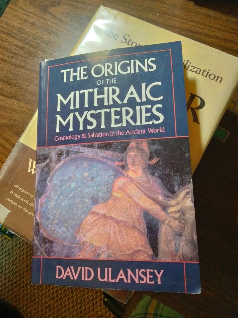
Book Review: The Origins of the Mithraic Mysteries by David Ulansey

I thought you should know that this book exists.

I don’t even remember where I got it. I have a feeling I got it at a used book store or a library sale, or maybe I stole it from my dad’s library. I know it’s been sitting around my study for a few years, waiting for me to get to it. It was published in 1989.

This is a good, accessible piece of scholarly work that first explains what the cult of Mithros was, then traces the history of scholarly thinking about it, and then advances Ulansey’s theory about what was really behind the cult.

What Is Mithraism

Mithraism began to spread throughout the Roman Empire in the first century C.E., reached its peak in the third century, and finally succumbed to Christianity at the end of the fourth century. At the cult’s height mithraea could be found from one end of the empire to the other, “from the banks of the Black Sea to the mountains of Scotland and to the borders of the great Sahara Desert,” as one authority puts it.

ibid, p. 4

As a result, many of the underground Mithraic temples whose iconography Ulansey shows pictures of are found in Germany or in Italy, although this is a cult that had its origins in Tarsus, in southern Turkey.

For a long time, the accepted theory among scholars was that the god Mithras got his start as the Iranian god Mithra, because they happen to share a name. However, the attributes of Mithras don’t line up very well with those of Mithra, which leaves the door open to other explanations.

The cult was apparently based on a story where Mithras slaughters a bull, and from the bull’s body sprang all the plants that man finds useful, such as wheat, grapes, etc. Because it was a mystery cult, nothing was ever written down about the secret meaning of this story, nor of the levels through which the neophyte progresses as he is initiated deeper and deeper into the mysteries. But in all Mithraic temples, there is consistent iconography. This includes a picture of Mithras slaying the bull, with wheat coming out of the wound. Mithras is typically looking away from the bull (though this is “corrected” in some reconstructions), wearing a distinctive hat which was associated with Persia and with Perseus in the ancient world. Around him are placed other figures which will prove to have significance in unravelling the meaning of the cult. Sometimes, the whole scene is placed under an arch or inside a circle that shows the zodiac. Sometimes, Mithras is also portrayed as standing inside a circle or hoop lined with star symbols.

A Brief Tour of the Ancient Mediterranean, Near East, and Europe

In unfolding his theory, Ulansey takes us on a fascinating tour of the ancient world. For example, he spends a lot of time establishing how and why Mithras came to be associated with (based on?) Perseus, who was the founder and hero of the city of Tarsus and, in fact, the local god of that whole region. (Mithras’ hat — a “Phrygian cap” — was originally worn by Perseus, and Ulansey contends that he looks away from the bull as he slaughters it because Perseus looked away from Medusa as he slaughtered her.) He gets into the fact that the cult may have originated with pirates of Cicilia, which lies just off the coast from Tarsus:

[T]he Cicilian pirates were far more than a mere band of thieves. Rather, the pirates, who numbered at least twenty thousand, formed what amounted to a small nation which at its height controlled the entire Mediterranean Sea.

ibid, p. 88

Ulansey then quotes Plutarch from Life of Pompey:

“The power of the pirates had its seat in Cicilia at first … then, while the Romans were embroiled in civil wars, the sea was left unguarded … until they no longer attacked navigators only, but also laid waste islands and maritime cities … There were also fortified roadsteads and signal-stations for piratical craft in many places … more annoying than the fear [the pirate fleets] inspired was the odious extravagance of their equipment, with their gilded sails, and purple awnings, and silvered oars … For you see, the ships of the pirates numbered more than a thousand, and the cities captured by them four hundred … Presently men whose wealth gave them power, and those whose lineage was illustrious, and those who laid claim to superior intelligence, began to embark on piratical craft and share their enterprises.”

ibid, p. 88

There are plenty of other fascinating historical nooks in this edifice, such as the figure of a lion-headed man, entwined by a snake, standing on a sphere; the idea of Mithras being born out of the rock; the exact nature of the Gorgon, and many, many others. Every single one makes sense when it comes up in context. That said, there were certainly some bizarre ideas floating around in the ancient world.

The Zodiac

So, to get right down to it, Ulansey’s case is that the Mithraic mysteries were a way of encoding astronomical knowledge. Because this is the ancient world we are talking about, this knowledge could equally be considered scientific, cosmological, and religious, as will become clear shortly.

Lately, I’ve been studying the zodiac in a desultory fashion. Don’t worry, I am not planning to take up astrology. Astrology is specifically forbidden to faithful Jews, and to children-of-Abraham-by-faith like myself. But it is of interest to me, because it was so important to the people of the ancient world. They worked it into their monuments and their mythology. The signs of the zodiac, and other constellations, were associated with the gods, and a good case could be made that this association started in pre-Flood days.

The other thing that fascinates me about the zodiac is that it’s so hard to observe. Now that I keep chickens and also work outside the home, I’ve been obliged to get up before dawn to let the chickens out. I live in a rural area with relatively dry weather, so you’d think it would be easy for me to take a quick glance at the horizon while I’m out there, and be able to tell which constellation is in the east, right where the sun is going to rise in an hour or two. As it turns out, it’s not so easy as all that. You not only have to know which direction is due east, you also have to have something that helps you sight where the sun is going to rise … and it moves. Then you have to be able to recognize the constellations. To really figure out the whole zodiac, you’d have to be making these observations daily, throughout all the seasons of the year, until you noticed that the constellations of the zodiac make a notional belt around the earth, and that at different times of year, they take turns “housing” the sunrise. This is already difficult enough that you’d have to have a pretty strong motivation to pursue it. (Stronger than mine is right now.) Ancient people thought this was so worthwhile that they managed to master the very difficult science of astronomy. Many ancient monuments, in fact, were built as observatories, from Stonehenge to many structures in the Americas.

Why were they so motivated to study the stars? That’s a discussion for another time.

According to Ulansey, the Mithraic iconography (and probably the whole cult) was designed to encode the secret of Equinoctal Precession. This is a really complicated phenomenon, so if you don’t know what it is, I’ll let you look it up. Basically, because of an irregularity in the earth’s rotation, the zodiac sign that “houses” the sunrise on the equinox will stay the same for 2,160 years, by which time the sunrise has migrated back to the previous zodiacal sign (hence, precession). (Also, incidentally, Polaris has not always been the the pole star.) Precession has been discovered at different times in the past by different civilizations. Graham Hancock makes a pretty good case that it was known by somebody, before conventional history began. But due to the difficulty of observing it, it has not been known at all times by all peoples. Around the time that the cult of Mithras apparently started, it had recently been discovered, and begun to be talked about, in the vicinity of Tarsus, in the same intellectual circles that were also providing aristocratic pirates.

Breaking Hoops and Wheels and Mills

Now, to you and me, equinoctal precession might fall into the category of “Oh, that’s interesting.” Not so for the ancients. For one thing, this cult probably started among pirates, who use the stars to navigate. The idea that the stars were once different and are not the same all the time would be earth-shattering to them. But this news gets even more ominous when we understand ancient cosmology.

(And when I say “ancient” here, I am talking about the cultures of the Mediterranean, Ancient Near East, and parts of Europe. Though, not to keep mentioning Graham Hancock, but in his book Fingerprints of the Gods he finds similar cosmology in ancient India, Central America, and Scandanavia. So a case could be made that this cosmology was once worldwide.)

This ancient cosmology, then, conceived of the heavens as a huge machine, constructed of two or more intersecting hoops (the zodiac, the celestial equator, and, essentially, the prime meridian/international date line projected into the sky). Sometimes the heavenly machinery is portrayed more as a big edifice with four pillars supporting it. Sometimes it’s a “mill” that turns. Probably some ancient people took this more literally than others; some understood it was notional, but represented something real.

Now, imagine that you think of the universe as a big, finely tuned machine, where the constellations always end up in the place they are supposed to be. If the whole hoop has moved out of its place, this could be conceived of as “breaking” the machine. This is why cycles of a certain number of years (not everyone got the precessional intervals right) were thought to bring cataclysms upon the world. So, we get myths worldwide about a mill being broken, and this causing the stars to fall from their places, the sky to become dark, fire and floods to sweep over the earth, etc. Again, read Hancock to find out more about this than you ever wanted to know.

But the point is, whether the Cicilian pirates thought that precession caused a cataclysm, or whether it just meant the universe was less stable than they had imagined, this would have been a revolution in their scientific, cosmological, and religious thought. (Religious because, in ancient times, science and cosmology and religion were really all a part of one system, especially when you consider that the stars and other heavenly bodies were thought to metaphysically influence events on earth.) So, whether you count it as belonging to three, two, or just one unified field of knowledge, this was a big enough discovery to be kept secret (a “mystery”) and passed on to initiates in a whole new cult religion.

Ancient People Knew About Mathematics

“Babylonians used the Pythagorean theorem 1,000 years before it was ‘invented’ in ancient Greece”

If you know me, you’ll know that I think this finding is cool, but not surprising. I believe that advanced mathematics were widely known in the ancient world. How else could the Giza pyramids have been built as a model of the stars of Orion’s belt (using pi in their proportions) … the temple complex at Teotihuacan been built as a model of the solar system (with the pyramids there also using pi in their proportions) … Stonehenge been built as an astronomical observatory that also functioned as a calculator … or the circular chambers at Gobekli Tepe been laid out forming a perfect equilateral triangle?

This doesn’t mean that every people group since the dispersion of mankind has had a knowledge of advanced mathematics. Obviously not. But either it was known to a central civilization and then lost in many cases, or else human beings are so clever that they are capable of discovering mathematical principles independently, whenever they have the need and the interest. Or both.

People are probably going to tell you that crediting the Pythagorean theorem to Pythagoras (through whom we first heard about it), rather than to the Babylonians, is racism. It’s not. In one sense, the fact that we credited Pythagoras was harmless. It was ignorance, not a cover-up. That was the farther our knowledge went; now, it goes a little farther.

But if we are super duper surprised that this theorem was in use 1,000 years before we thought it was, then we might be dealing here with an equally wrongheaded attitude. Instead of looking down on some peoples based on their skin tone, this is looking down on them based on the fact that they lived and died just too long before we were born. It’s the assumption that modern people are better at abstract thought, science, and technology than ancient people. Though self-flattering, this belief isn’t just an irrational prejudice. It’s a consequence of the evolutionary presupposition that people started out as animals, and that we had to slowly develop things like language, music, art, religion, mathematics and all kinds of higher thought. Thus, by definition, modern people should be smarter and our technology and mathematics more advanced than those of ancient people. The silent testimony of megalithic monuments all around the world belies this.

Anecdotal Evidence for a Worldwide Flood

Photo by Ray Bilcliff on Pexels.com

As I heard a podcaster say, “The plural of anecdote is data.”

Wait. Are We Even Sure It Was Worldwide?

You can make a case that the account in Genesis 7 – 8 is not necessarily describing a global flood. This is because the same Hebrew word can be translated “world,” “earth,” or “land.” How we interpret it depends upon context. There is a case to be made, for example, that the whole book of Revelation is describing the devastation of the land of Israel during the destruction of Jerusalem in 70 A.D. (hence the frequent warnings that it is going to happen “soon”), and that lines like “one third of the people on the earth died” are better translated as “one third of the people in the land died.”

I have even seen people try to interpret the poetic descriptions of creation in Genesis 1 and 2 as happening from the perspective of a person standing on the surface of the earth, in the land of Israel.

However, getting back to the flood narrative, there are good reasons to think that the text is in fact describing a global flood. This passage is set in very ancient times, before the nation of Israel existed. It’s before Abram was called by God out of Ur. Before Abram was even born. Before the Table of Nations (Genesis 10). So, not only was there no nation of Israel at the time of flood narrative, but we can’t even be sure there was a land of Israel, given the dramatic damage that the flood did to the earth’s geography. (And by the way, yes, I have just revealed that I think the flood narrative was not composed by Moses — even under the inspiration of God — but was passed down to Moses from a much older source.)

Finally, it’s hard to imagine how a local flood could “cover the mountains to a depth of more than fifteen cubits” (Genesis 7:20) … especially for enough of a length of time for Noah and his sons to take soundings so as to estimate this depth.

So, given all this, I don’t think it’s straining the text to say that the flood account in Genesis is meant to be describing a global event.

Like so many sensational things in the Bible, the flood account sounds hard to believe, but the longer we look at it, the better it matches with the world we live in. Here are some features of the world we live, which are features we would expect if the dark millennia of our past concealed a worldwide flood.

Oral Flood Histories from Around the World

I have written before about Graham Hancock. I really enjoyed his book Fingerprints of the Gods, which posits an ancient period of cataclysms that included “earth crust slippage,” a geological upheaval so dramatic that it would have caused catastrophic floods among many other disasters. Hancock keeps changing his theories, and he has his own reasons for collecting the historical data that he does. However, here is some of the data that he conveniently collected about flood legends worldwide:

More than 500 deluge legends are known around the world and, in a survey of 86 of these (50 Asiatic, 3 European, 7 African, 46 American and 10 from Australia and the Pacific), the specialist researcher Dr. Richard Andree concluded that 62 were entirely independent of the Mesopotamian and Hebrew accounts.

Hancock, Fingerprints, p. 193
People Grouppage in Fingerprintssummary
Aztec98“First Sun, Matlactli Atl: duration 4008 years. In this age lived the giants … The First Sun was destroyed by water in the sign Matlactli Atl (Ten Water). It was called Apachiohualiztli (flood, deluge), the art of sorcery of the permanent rain. Men were turned into fish. Some say that only one couple escaped, protected by an old tree living near the water. Others say there were seven couples who hid in a cave until the flood was over and the waters had gone down. They repopulated the earth and were worshipped as gods in their nations …”
Sumerian188 – 189The Noah figure is called Utnapishtim. He later tells his story to Gilgamesh. It almost exactly parallels the Genesis 7 account.
South American tribes191 – 192Hancock mentions flood accounts coming from the following tribes: Chibcas (Colombia); Canarians (Ecuador); Tupinamba (Brazil); Araucnaian (Chile); Yamana (Tierra del Fuego); Pehuenche (Tierra del Fuego); and numerous groups in Peru.
Inuit 192 – 193“a terrible flood, accompanied by an earthquake, which swept so rapidly over the face of the earth that only a few people managed to escape in their canoes or take refuge on the tops of the highest mountains.”
various North American tribes193Lusieno, Huron, Montagnais, Iroquios, Chickasaw, Sioux
China’s Imperial Library193 – 194“The planets altered their courses. The sky sank lower towards the north. The sun, moon, and stars changed their motions. The earth fell to pieces and the waters in its bosom rushed upwards with violence and overflowed the earth.”
Southeast Asia194Flood accounts in: Chewong (Malaysia); Laos and northern Thailand; Karen (Burma); Vietnam; tribes along the northern coast of Australia
Hawai’i194“The world was destroyed by a flood and later recreated by a god named Tangaloa.”
Samoa194The flood is survived by “two human beings who put to sea in a boat which eventually came to rest in the Samoan archipelago.”
Japan194The Pacific islands were formed after the deluge receded.
Greek (Hesiod)195 – 196After a series of races of gold and silver, there is a “bronze race” who “have the strength of giants, and mighty hands on their mighty limbs.” After Prometheus gets them into trouble, Zeus wipes out the bronze race with a flood. Deucalion and Pyrrha float over the sea in a box for nine days and finally land on Mt. Parnassus.
“Vedic India”196 – 197The Noah figure is named Manu. He rescues a fish, which in return warns him of a coming flood. Manu loads a ship with two of every living species and seeds of every plant. The fish turns out to be Vishnu, who pulls Manu’s ship through the flood.
Egypt (Book of the Dead)197Thoth says, “They have fought fights, they have upheld strifes, they have done evil, they have created hostilities, they have made slaughter, they have caused trouble and oppression … I am going to blot out everything which I have made. This earth shall enter into the watery abyss by means of a raging flood, and will become even as it was in primeval time.”
Mayan (Popol Vuh)203“It was cloudy and twilight all over the world … the faces of the sun and moon were covered … Sunlight did not return till the twenty-sixth year after the flood.”
Norse204 – 205An awful lot happens in this apocalyptic tale. First a “hideous winter,” then worldwide war, then Yggdrasil (the earth tree) is shaken, causing the earth to literally fall apart. Then, worldwide fire. And finally, a flood. “The earth sank beneath the sea … Yet not all men perished in the great catastrophe. Enclosed in the wood itself of the ash tree Yggdrasil — which the devouring flames of the universal conflagration had been unable to consume — the ancestors of the future race of men had escaped death. In this asylum they had found that their only nourishment had been the morning dew. Slowly the earth emerged from the waves. Mountains rose again …”

The charming thing about these origin tales is that couple who survive the flood usually end up landing on the local mountain, founding the nation that is currently telling the story, and not moving from that spot ever since. This is similar to how nearly every people group has a local landmark (usually a mountain, terrain permitting) that is believed to be the home of the gods or “the center of the world.”

This is what origin stories are supposed to do. They ground the local community in the great ancient story of the world, and they also give the ancient stories credibility by grounding them in local features “still seen to this day.” This is not to say, however, that origin stories are simply made up out of whole cloth. They are handed down the generations, and though they might get tailored to make human beings look better, and have bits of other interesting stories added to them, they ultimately have some kind of origin in actual events. (Especially since they often come with genealogies that are also handed down.) I can’t imagine the coincidence that would be required for hundreds of peoples all around the world to make up a traditional flood story.

Yes, But It Could Still Have Been Local, If …

… if all of these widely scattered people groups were descended from a small number of couples who were once all in one place and who experienced a catastrophic local flood together.

That is true. Could still be true. And, in fact, even if the entire world were experiencing earthquakes, uplifts and sinkings, tsunamis, etc., all at once, there wouldn’t necessarily have been a moment when water was covering all the land on earth all at the same time. On the other hand, there wouldn’t have to be, for events to satisfy the description given in these flood accounts, including the Genesis one. After all, the perspective from which these stories are told, is that of human beings experiencing the flood and associated disasters, not the perspective of an observer looking at the globe from outer space. The mental picture of the whole world sitting under a flat layer of water, while not impossible, is more of a Sunday School stylization of the account, than the actual claim being made.

Buried Beneath a Wave of Mud

In all of these accounts, the flood is sudden, dramatic, and overwhelming, whether or not it is accompanied by other disasters such as earthquake or fire. Even the Genesis account (often simplified to sound like just rain) says “on that day all the springs of the great deep burst forth, and the floodgates of the heavens were opened” (Genesis 7:11, NIV).

In a world in which this had happened, we should expect to find the remains of plants and animals that had been instantly buried under huge waves of mud and essentially frozen in time. And that is exactly what we do find. Here is the latest example, which was called to my attention by Google within the last month:

dinosaur fossilized while sitting on her eggs

This poor dino mom, if she had been given any warning that she was about to be buried in an oxygen-free environment that would later prove convenient to future paleontologists, would probably have fled or tried to move her eggs to safety. OK, maybe she would have stayed to protect them. But we also find fossil dinos caught in the act of, say, eating prey. We find mammoths apparently flash-frozen with summer plants still in their mouths and/or stomachs. I can’t imagine how that could have come about, but it can’t have been gradual. (Although here are some fish who appear to be frozen in a wave, but the process was a quite different.)

It’s an odd world we live in, guys. I dunno.

Ancient People Were Really Smart, Part … What? 10?

“Massive stone structures in Saudi Arabia may be some of the oldest monuments in the world.”

They number in the hundreds, can be larger than an NFL football field and are found across Saudi Arabia. … radiocarbon dating of charcoal found within one of the structures indicates people built it around 5,000 B.C.

“This ‘monumental landscape’ represents one of the earliest large-scale forms of monumental stone structure construction anywhere in the world.”

Ibid

Oooh, so many thoughts.

We keep finding these things everywhere. And every time one is found, it’s older than expected, such that it seems we are constantly being told that “the earliest” or “one of the earliest” has just been found.

There is Gobekli Tepe in Turkey, the earliest (?) stone temple.

There are standing stones, marching stones, and stone circles all over the Middle East and Europe.

There are crannogs in Scotland (apparently Neolithic), and the Stone Serpent of Loch Nell.

The Giza pyramids, and the Sphinx, are arguably much older than commonly believed.

So, I don’t necessarily believe that these monuments in Saudi Arabia are “the first” of anything (even though, I’d like to point out, the monument could be older than the charcoal they found in it).

What I do believe is that they are yet more evidence that the compulsion to build massive stone structures, and the engineering skills to pull it off, was near universal among ancient humanity.

It looks most probable to me that these “earliest monuments” in Arabia were contemporaneous, or nearly so, with the other “earliest stone monuments” and temples and things that we keep finding, all over the world.

Perhaps people were dispersing from somewhere (somewhere near the Fertile Crescent, say), taking this building culture with them as they went. They would have hit northwest Arabia fairly quickly. The Table of Nations, in Genesis 10, lists all the peoples that descended from Noah’s three sons after the Flood. Though this is supposedly a comprehensive list, when it tells where they settled, the homelands listed for them are all in the Fertile Crescent, the Levant, and Arabia, though it is obvious that some of these peoples eventually ended up settling in much more far-flung places.

See also my posts about The Lost Civilizations of the Stone Age, by Richard Rudgley, who presents evidence that fully functioning human civilizations existed 10,000, 20,000, or even 30,000 years ago.

Just a thought for the day.

Gobekli Tepe, the World’s Oldest Temple?

Photo by Tim Mossholder on Pexels.com

I wonder whether you’ve ever heard of Gobekli Tepe. I hadn’t until just a few years ago, which makes sense because it wasn’t rediscovered (and so, presumably, begun to be excavated) until the 1990s.

It’s called the world’s oldest temple because it dates back more than 10,000 years. In the article I will link to below, dates of 11,500 years ago and even 15,000 years ago are mentioned. This puts it in the Neolithic: the Stone Age. Like many other ancient complexes that have been given more recent dates, it is made of megaliths placed with geometrical precision.

The Dating of Gobekli Tepe

It sounds really to cool to say that a til-recently-unknown stone structure in Turkey with an exotic name is the “world’s oldest temple.” But as we sometimes mention on this blog, it’s very possible that some of the other megalithic structures found around the world are in fact older than conventional dating would have it. An argument has been made, for example, that the Sphinx and the pyramids at Giza are closer to 20,000 years old. Gobekli Tepe, then, is the oldest megalithic temple that has been able to convince mainstream archaeologists of its bona fides. At any rate, it clearly hails from a very ancient time when people all over the world were for some reason (and with some method???) building stuff with megaliths.

The ancientness of Gobekli Tepe creates a problem for its excavators when its obvious sophistication comes into a head-on collision with their beliefs about the abilities of Stone Age humans. That clash happens several times in the Jerusalem Post article Israeli researchers unveil architecture secrets of ‘world’s oldest temple.’

Two archaeologists from Tel Aviv University, PhD candidate Gil Haklay and his supervisor, Prof. Avi Gopher, have now unveiled new secrets of its sophisticated architecture, highlighting an intricate geometrical pattern that was conceived before humans had even discovered agriculture or pottery.

Ibid

… Um, are you sure they hadn’t discovered agriculture or pottery, Professors?

Göbekli Tepe features dozens of monolithic pillars four to five meters tall placed along at least 20 concentric rings, which archaeologists refer to as “enclosures.” The pillars are decorated with remarkable reliefs depicting animals including gazelles, jaguars, Asiatic wild donkeys and wild sheep. …

“We found that there is a center point in each enclosure, which we identified not only in the three in the main excavation area, but also in others located outside it,” Haklay explained. “We also found out that the center of these enclosures was always located between the two large central pillars aligned with the front side. These pillars also presented an anthropomorphic structure and they have a front side. In each enclosure based on the surrounding peripheral pillars was found an alignment with the narrow front side. This was our first observation: an abstract design rule.“We later noticed that the role of those center points extended beyond an individual enclosure, because the three center points of enclosures B, C and D form an almost perfect equilateral triangle,” he added.

Haklay highlighted that they went on to verify whether the geometric pattern was confirmed by further observations, for example the orientation of the central pillars. They found many other elements supporting it. Among others, the main access to the structure was located between the only two pillars carrying anthropomorphic as opposed to animal reliefs.

Ibid

But how was all this accomplished?

[I]t is not clear how long its construction took but it might have been centuries if not more, with different people initiating it and adding to it.

Ibid

But yet later, we get this:

This discovery also overcame a previous theory common among researchers that the enclosures were conceived and built in unrelated stages.

Ibid

Huh? So it was built over hundreds of years, added to a little at a time, but yet planned by one or a few masterminds?

“We are talking about hunter-gatherers, but at the same time we see signs of a very complex social structure,” Haklay said …

But how could such a complex design be envisioned by people who did not even know how to create a simple pottery vessel?

Ibid

Oh, stop. Just … stop.

Gobekli Tepe in Fiction

There is one novel that I know of which focuses squarely on Gobekli Tepe: The Genesis Secret, 2009, by Tom Knox. See my review of it here. Interestingly, though Knox is not a believer in the Judeo-Christian God (quite the opposite, in fact), he takes seriously the accounts of giants walking the earth in Genesis 6 and, in fact, his novel ends up revealing that Gobekli Tepe was built at the initiation of a violent, giant race who left large, misshapen skulls behind them.

In film, within the last year I saw on a Netflix a Turkish show called The Gift. In it, a young artist who lives in Istanbul finds that a symbol she has spontaneously drawn all her life has recently been uncovered at the ancient site of Gobekli Tepe. I enjoyed this show, but be warned it has some entirely gratuitous sex scenes.

And Now, for a Really Wild Speculation …

People who take Genesis seriously as history have speculated about the location of the original Garden of Eden. Genesis mentions four rivers as arising from the Garden (or running into it; the linguistics are ambiguous). Two of these are the Tigris and Euphrates. The other two (the Gihon and the Pishon) have been lost to time.

Of course, to try and locate the original Garden is probably impossible. If you suspect, as I do, that the Flood was a result of continental-drift like changes in the Earth’s geography, then nothing anymore is located where it was in Adam’s day, including rivers. On this view, the modern-day Tigris and Euphrates are probably just named after some much more ancient rivers, which could have been in a completely different location.

But if we assume that the continents look more or less the same now as they did in Adam’s day, we can try to guess the region where Eden once stood. One likely candidate is northeastern Africa, or even what is now the floor of the Red Sea (sea levels having risen).

Another candidate is the mountainous region of eastern Turkey, near the headwaters of the modern-day Tigris and Euphrates, along with several other rivers.

And also not too far from Gobekli Tepe.

Just sayin’.

The Maya Microcosm of Humanity

The Maya flourished between approximately 1000 BC and 1500 AD in Central America. Their civilization was centered in the Yucatan Peninsula and the lowland and hilly regions south of it. Their sites are found in what are now the countries of Mexico, Belize, Guatemala, and Honduras.

There is so much to learn about the Maya. I have barely dipped my toe in it. As always when learning about a new culture or civilization, I was met with the thrill of the exotic followed by a creeping feeling of familiarity. Though the Maya are very unique, in their own distinctly Mayan way they also epitomize certain things about human beings. In some sense, the more unique they are, the better they epitomize it.

They Are Surprising to Other People

I don’t know why, but people always get excited when they discover other people. (Animals get excited too: “Oh goody! A person!”)  And we are always discovering other people, in the most remote corners of space and time, where for some reason we did not expect to find them, though you would think we’d have learned our lesson by now.

The Maya were particularly hard to find because of the geography of the region they inhabited. Jungle is not kind to the preservation of buildings or artifacts. It destroys things quickly, grows over things and hides them, and can make the region impassable.

Tree destroying a stone arch. From Mysteries of the Ancient Americas, p. 165

A really thick jungle allows no roads through it, and once they arrived, here is what some of the archaeologists found:

“The rain was incessant,” Charnay complained. “The damp seems to penetrate the very marrow of our bones; a vegetable mould settles on our hats which we are obliged to brush off daily; we live in mud, we are covered in mud, we breathe in mud; the ground is so slippery that we are as often on our backs as on our feet.” Once Charnay awakened to find 200 “cold and flat insects the size of a large cockroach” in his hammock, 30 of which clung to his body and bit him painfully.

The Magnificent Maya, p. 22

They Got Romanticized

In the early 1500s, during the Spanish conquest of the region, Spanish priests managed to preserve some Mayan cultural data – vocabulary lists, transcriptions of myths, and a few codices (books) – at the same time they were brutally wiping the culture out. These records remained obscure until, 300 years later, there was a resurgence of interest in the Maya. Explorers, hobbyists, and artists who happened to have the time, money, and fortitude to brave the jungles started unearthing Mayan ruins and making sketches and watercolors of them. In some cases, these sketches are the only record we have, since the jungle has continued its destructive work in the 200 years since.

Once European academics started getting interested in the Maya, they realized there was a very elaborate system of numbers and pictographs that they could not read.  Thus began a long, haphazard process of rediscovering old codices and cross-checking them with symbols found on the monuments, as recorded in photographs and drawings. The number system was easier to decipher – dots for ones and bars for fives, for example – and so the first thing that got decoded were dates and astronomical cycles,

… which led many experts to conclude that Maya writing was limited to such matters. As late as the 1950s this was still the most prevalent view, and its chief spokesmen were the American archaeologist Sylvanus G. Morley of the Carnegie Institution in Washington, D.C., and J. Eric S. Thompson, a British archaeologist also affiliated with Carnegie. Thompson drew a picture of the Maya as a peaceful, contemplative people, obsessed with the passage of time, and guided by priests who watched the movements of celestial bodies and discerned in them the will of the gods. Maya cities were ceremonial centers, he believed, not bastions of the worldly power.

The Magnificent Maya. p. 33

Over the next few decades, through the work of several brilliant code breakers, about 80 percent of Mayan glyphs were deciphered. Turns out they are a combination of ideograms (an image representing an idea) and phonetic units (an image representing a sound).  As this work went on, researchers have been able to read more and more of the Mayan myths and history, which in turn has helped us better to interpret their art. They started to discover that the 19-century “noble savage” characterization of the Maya was badly mistaken.

They Were Shockingly Cruel

First of all, the Mayan society was indeed hierarchical, with battles for succession and kings of city-states engaging in (perhaps ritual?) warfare. Discoveries during the 1990s confirmed that this hierarchy was present hundreds of years earlier than previously guessed.  (Archaeologists’ preconceptions might have had something to do with these inaccurate guesses. See my post about Serpent Mound for a critique of the 19th-century idea that civilizations always develop along certain lines, from hunter-gatherers, to villages, to cities.)

from The Magnificent Maya, p. 108

But warfare was only the beginning. There was also the bloodletting, the torture, and the human sacrifice.

Apparently, Mayan royalty were expected to offer blood to their gods. During these bloodletting rituals, they would have visions. There are pictures and statues of both men and women doing this. Women would draw a stingray spine through their tongue to produce the blood. Men would draw blood from their tongue, earlobes, or genitals. (Yikes.) They would allow the blood to be absorbed by sheets of bark paper, which was then burned, the smoke being a way of getting the blood to the gods.

If a culture is going to have a painful ritual, it’s good that it should be done by the royalty. That’s certainly better than having a royalty that is unwilling to suffer for their duty and their people. If this were the only painful ritual the Maya had, I’d kind of admire it. But it wasn’t.

The Maya were big on human sacrifice. Decapitation was popular, or they might throw the victims into a sacred cenote (large natural limestone hole filled with water) if one was available. High-born victims, captured in war, would be mutilated and displayed before the community before being offed. Later, perhaps under the influence of the feathered-serpent cult of the Toltecs, Mayan priests would cut out the victim’s heart, offer it (and its steam – ew!) to the sun, and then kick the body down the steps of the temple. This ritual was still being conducted at Uxmal in the 1500s, which is why we know about details like the kicking of the body (Magnificent Maya, 139 – 140).  Chacmools, which were obviously built to hold something, may have been made to hold human hearts.

The Magnificent Maya, p. 136. Temple of the Warriors at Chichen Itza. The reclining statue holding a bowl is the chacmool.

Then there were the ball games. Did I mention that the Maya were big sports fans? Like, really big. You have probably heard of this game, where the players would use their hips and buttocks to bounce a large, heavy rubber ball off the sloping walls of the court. Apparently, the Maya took their sports so seriously that the losers of this game might be sacrificed, either by one of the methods above, or by being trussed up and used as the ball until they died (94 – 95).  This very ball game features in the Mayan creation story, the Popol Vuh, where the Hero Twins play the game against the inhabitants of the Underworld. The reason they are obliged to do so? The rulers of the Underworld “covet [the brothers’] sporting gear and want to steal it” (56 – 57). This story, too, features a lot of torture.

Cruelty is always shocking, which is why the heading for this section says “shockingly cruel.” But it should not shock us to discover that a previously unknown civilization featured widespread, institutionalized atrocity. Every single human culture has something like this. Cultures can have good historical moments when the human evil is comparatively restrained, and they can have bad historical moments when it is encouraged. You could argue that in the case of the Maya, it had really gotten out of hand, and I think you’d be right. But I don’t think that makes the Maya different from any other people in their basic humanity. In their uniqueness, they epitomize what human beings are capable of. People are extremely creative, and they have often used their creativity to dream up ways to torture one another. This is why we have the expression, “Man, the glorious ruin.”

They Were Jaw-Droppingly Smart

from Fingerprints of the Gods, photo plate between pages 134 – 135. I have no idea how this light and shadow serpent effect was accomplished, but if true, it’s an amazing piece of engineering.

And now we get to the glorious part. No matter how depraved, broken, fallen, or ruined they may be, human beings never stop being made in the image of God, which means they will keep on being creative and clever and productive. It has long been a theme on this blog that ancient people were smarter than modern people expect. This is because they were people, and people are always surprising other people – because the other people are proud – with their cleverness.

The Maya were advanced mathematicians. They had the concept of zero, and the idea of place value, which the Romans did not have. They had calculated the solar year at 365.2420 days (the modern calculation is 365.2422), and the time of the moon’s orbit at 29.528395 days (modern figure is 29.530588). They had figured out the average synodical revolution of the planet Venus (the amount of time it takes for Venus’s orbit and the earth’s orbit to sync up so that Venus is rising in the exact same spot in the sky). This average happens to be 583.92 days, and they had figured out how to reconcile this with their “sacred year” (13 months of 20 days each) and with the solar year, by adding days every certain number of years, similar to our leap year.  Bringing all these interlocking calendars into sync then allowed them to calculate mind-blowingly distant dates without losing accuracy.

All the above information is from Graham Hancock in Fingerprints of the Gods. Hancock then quotes Thompson, the romanticizer whom we met a few sections ago. Studying the Mayan calendar, Thompson had reason to be impressed:

As Thompson summed up in his great study on the subject:

“On a stela at Quiriga in Guatemala a date over 90 million years ago is computed; on another a date over 300 million years before that is given. These are actual computations, stating correctly day and month positions, and are comparable to calculations in our calendar giving the month positions on which Easter would have fallen at equivalent distances in the past. The brain reels at such astronomical figures.”

Hancock, Fingerprints of the Gods, p. 162

Hancock, being a bit of a snob, questions why the Maya “needed” to develop these calendrical and mathematical tools. He speculates that the Maya had inherited “a coherent but very specific body of knowledge … from an older and wiser civilization.”

“What kind of level of technological and scientific development,” Hancock asks, “was required for a civilization to devise a calendar as good as this?” (158 – 159)

Of course, he is asking these questions because he’s heading in the direction of civilization having dispersed from a “mother-civilization.” That’s fine with me, but in asking these questions he also betrays a worship of science and technology that is distinctly modern and that, when applied to ancient peoples, makes us shortsighted. Why should mathematical genius exist only in the service of technology? The Maya were smart, and they wanted to make these calculations about the celestial bodies and about dates in the distant past and future. Isn’t that enough? Furthermore, they actually recorded why they were so obsessed with these calculations. Their cosmology held that time proceeded in predictable cycles of disasters, and they were pretty concerned with knowing when the next one was coming. That was the purpose of the Long Count calendar, as Hancock himself points out on page 161. It was a doomsday clock. That may also have been a big part of the reason for the horrifying sacrificial system.

The Long Count calendar is what everyone was talking about when they were saying the Maya had predicted a cataclysm for Dec. 23, 2012.  It didn’t happen – phew! – and, frankly, for obvious reasons I don’t completely buy in to their cosmology. Although we do need to consider the possibility that in converting the dates, we made a mistake in interpreting their extremely complex system.

Bottom Line, the Mayans are People

I can’t say that I find the Mayan – or the Toltec, Aztec, or Olmec – myths or aesthetic particularly attractive. I dipped my toe in because as part of the research for my books, I need to at least know my way around the ancient Mesoamerican mindset. As the research proceeds, I find myself becoming increasingly fascinated with these people. But I still wouldn’t want to have lived as one. This has been true of virtually every ancient culture I’ve studied.

So, taking it in reverse order, here is what we have learned about the Maya, and here is what we have learned about humans.

Humans are smart.

Humans are evil.

Humans are wonderful.

Humans are everywhere.

Sources

Hancock, Graham, Fingerprints of the Gods. 1995, Three Rivers Press, Random House, Inc., New York, New York.

Reader’s Digest books, editors, Mysteries of the Ancient Americas. 1986, The Reader’s Digest Association, Inc., Pleasantville, New York.

Time-Life books, editors, The Magnificent Maya. 1993, Time-Life Books, Alexandria, Virginia.