Graham Hancock’s Big Idea

Photo by Ylanite Koppens on Pexels.com

In this post I attempt to summarize Graham Hancock’s book Fingerprints of the Gods: The Evidence of Earth’s Lost Civilization (1995). This book influenced the background for my novels. It also, in my mind, dovetails with Douglas Van Dorn’s biblical/archaeological research on giants in ways that I am sure Hancock never intended or imagined.

This post is only a summary. It will naturally be much less convincing than the book itself. My copy of Fingerprints runs 578 pages counting the bibliography and index. Hancock builds up to his thesis slowly, presenting many different lines of evidence and dropping mysterious hints to keep the reader intrigued. He also has to get into some fairly technical topics, particularly when talking about astronomy. I can’t do any of that in a 1,000-word post. So, like a bucket of cold water in the face, you will be treated to Hancock’s thesis in all its bizarre and fascinating glory.

Incredibly Sophisticated, Incredibly Ancient Maps

Hancock’s first two chapters are dedicated to the details of a number of old maps drawn up during the 1500s which show parts of South America that were undiscovered by Europeans at that time. More intriguingly, they show the coast of Antarctica as it appears under the ice. (This was before modern man’s discovery of Antarctica, and before seismic surveys revealed what lay beneath the ice.) The best-known of these is the Piri Reis map (drawn up in A.D. 1513), but there are others, such as the Orontes Finaeus map, the Mercator map, and the Buache map. All these mapmakers drew on older maps, which they compiled. Piri Reis, for example, had access to the Imperial Library at Constantinople, which is probably where he got the sources for his map.

The other amazing thing about these old maps is they often show locations in South America, for example, at accurate longitude and latitude.

The lesson that Hancock draws from these maps is this. Whatever source maps Piri Reis and others used, must themselves have been drawn up by an advanced seafaring civilization that had explored the world and knew how to project longitude and latitude. Amazingly, these seafarer/mathematicians apparently charted Antarctica at a time when it was not yet completely covered in ice. That makes their civilization, how do you say? Very, very old.

Ancient Astronomer/Engineers Again

Hancock then turns to the sophisticated ancient buildings that have baffled us in previous posts. He dedicates ten chapters to the Incan and pre-Incan civilization: the Nazca Lines, the amazing complex at Lake Titicaca, and the tradition that connects these to a bearded culture-bringer (the Viracocha), who came from over the sea.

Eleven more chapters describe the Central American cultures: their obsession with numbers, with calculating exact dates in the distant past and future, with forestalling the apocalypse (including by human sacrifice). They were also sophisticated astronomers. The pyramid complex at Teotihuacan, for example, appears to have been laid out as a scale model of the solar system.

And then there is ancient Egypt. Seventeen chapters are dedicated to it. There are many things to notice. Here are just a few: ancient Egyptian civilization seems to have appeared suddenly as a high civilization, complete with myths, history, engineering, and an obsession with boats. Overall, its history is one of slow decline and loss of knowledge, rather than slow buildup. (Interestingly, the same point has been made about ancient Sumer.)  

The pyramids at Giza do not match the pyramids that are supposed to have been built immediately before and immediately after them. They are far more durable and sophisticated than these others. If we accept the received chronology, the Egyptians built some relatively crummy pyramids, then a few generations later built some amazingly good ones, then turned around and went back to building relatively low-quality pyramids again. Hancock suggests that instead, the Giza pyramids are much older than commonly thought. They were built with knowledge or technology that was subsequently lost. The comparatively crummy pyramids are attempts to copy the ones at Giza.

Hancock writes, “Robert Bauval’s evidence showed that the three pyramids [at Giza] were an unbelievably precise terrestrial map of the three stars of Orion’s belt, accurately reflecting the angles between each of them and even (by their respective sizes) providing some indication of their individual magnitudes. Moreover, this map extended outwards to the north and south to encompass several other structures on the Giza plateau … the Giza monuments were so arranged as to provide a picture of the skies … as they had looked – and only as they had looked – around the year 10,450 BC.” (page 356)

The Great Pyramid at Giza has a ratio of 2pi between its original height and the circumference of its base. This strengthens the argument that it was meant to represent a star (a circle). The Pyramid of the Sun at Teotihuacan has a ratio of 4pi between height and base circumference. Both of these pyramids had to have an odd angle of slope to accomplish this (52 degrees for Giza; 43.5 degrees for Teotihuacan), so it seems to have been intentional. Pi was supposedly not calculated correctly until it was done by Archimedes in the third century BC, but apparently the ancient Egyptians and the ancient Mexicans were familiar with it.

Where Hancock is going with all this is that people on both sides of the Atlantic got their amazing engineering, mathematical, and astronomical knowledge from an older “source” civilization. He thinks it was the same seafaring civilization that apparently charted Antarctica. This impression is strengthened by the Egyptian obsession with boats and by the Incan legends that say all this knowledge came from over the sea.

Is Hancock Arguing for Aliens?

Not in this book.

He has written several books about ancient mysteries. I have not read them all. He has now started writing fiction, and in the one novel of his that I have read, it becomes apparent that his interest in all this is decidedly New Age in character. The novel features an angelic/earth mother spirit guide, telepathic Neanderthals, the whole nine yards. So, I can’t swear that aliens won’t show up at some point. But that is not the thesis of Fingerprints.  Hancock is arguing that there was a very advanced civilization of people well before 10,000 BC. Whether these people were taught by aliens, spirits, or some other stuff like that, he does not say, thankfully. Because, luckily, this book relies heavily on evidence.

So the ancient cartographers were not aliens, not even according to Hancock. But still we have a problem: Where was this civilization located? You don’t normally get an advanced civilization until you have a critical mass of arable land. In short, a continent. Hancock believes he has solved this problem. He believes there was such a mass of land, but that it has since undergone a cataclysm. And now we come to the really wild part of his thesis.

It’s the End of the World As They Knew It

Mythology about a period of cataclysms in ancient times is universal. Hancock dedicates four chapters to this alone. Flood myths, for example, are very common. But most cultures also record things like earthquakes, fire falling from the sky, the sun not rising for some long period of time, or an endless winter. Hancock discusses myths like this in some detail from the following cultures: Aztec, Sumerian, Greek, Inuit, Chinese, Southeast Asian, Pacific, Indian, Egyptian, Mayan, and Norse. It should not be hard for the reader to track down these myths. Some cultures (the Aztecs and the Hopi, for example) believe that disasters come at regular intervals and that each one ushers in a new age of the world.

Hancock believes that these myths are actually historical records (with all the usual caveats about them becoming garbled, etc.) of a period of geologic upheaval that happened within human history. I’ll put it in his own words:

“This geological theory was formulated by Professor Charles Hapgood and supported by Albert Einstein. What it suggests is a complete slippage of our planet’s thirty-mile-thick lithosphere over its nearly 8000-mile-thick central core, forcing large parts of the western hemisphere southward towards the equator and thence to the Antarctic Circle. This movement is not seen as taking place along a due north-south meridian but on a swivelling course – pivoting, as it were, around the central plains of what is now the United States. The result is that the north-eastern segment of North America (in which the North Pole was formerly located in Hudson’s Bay) was dragged southwards out of the Arctic Circle along with large parts of Siberia [which were dragged into the Arctic Circle].

“In the southern hemisphere, Hapgood’s model shows the landmass that we now call Antarctica, much of which was previously at temperate or even warm latitudes, being shifted in its entirety inside the Antarctic Circle. The overall movement is seen as having been in the region of 30 degrees (approximately 2000 miles) and as having been concentrated, in the main, between the years 14,500 BC and 12,500 BC – but with massive aftershocks on a planetary scale continuing at widely-separated intervals down to about 9500 BC.” (page 471)

So that’s the thesis. Here are the things it explains:

  • Why North America was once covered with glaciers, centered around Hudson Bay, and why they suddenly started melting.
  • Why, during the same period of time, Siberia was apparently not covered in glaciers
  • Why there is evidence that the climate was once much warmer in parts of Siberia. We find flash-frozen mammoths with temperate or even tropical plants still in their mouths and stomachs. (Actually, I still don’t understand how mammoths could be flash-frozen even with Hancock’s thesis. But at least it offers some explanation.)
  • Why there is evidence that the climate was once much warmer in Antarctica as well.

Furthermore:

  • According to Hancock’s theory, the survivors of this advanced civilization that previously existed on what is now Antarctica fled their homeland, taking their science with them.
  • They settled in other parts of the world and tried to rebuild.
  • Hancock also thinks that they deliberately seeded myths and cults to preserve knowledge and to draw people’s attention to the processional cycle of the constellations because they wanted to warn them. They believed that geological disasters like this occurred cyclically in concert with celestial events. He believes this is why the pyramids were built, for example. A good chunk of his book is about this, but I don’t have time to relate it here.

What’s a Christian Writer to Do With All This?

First of all, it is not possible to integrate everything. It just isn’t.

To take just one example from above, if the earth’s crust took 2,000 years to slip, how did mammoths come to be flash frozen? I have no idea. I don’t think anybody does, whatever their theory.

To take another example, Hancock’s thesis requires that after the age of cataclysms, there were human survivors in scattered parts of the world. These were then visited by refugees from the mother civilization, who taught them things, and they remember these culture-bringers in their mythology. You cannot make this work perfectly with the idea that at one point there was a universal flood that wiped out all humankind except four couples, and that the flood myths are memories of that.  

Every culture has stories of culture-bringers (human or divine) who taught them to do things that are basic to that culture. Most cultures with a flood myth have the survivors of the flood landing right in that culture’s homeland and becoming the direct ancestors of that culture. Most of them don’t have a section in there where the survivors land somewhere very far away, and then their descendants travel a really long way to get to the current homeland. Most peoples believe that they live at the mythic center of the world. So you have to take these things into account. Every origin myth cannot be true in all its details.

That said, here is what I, as a Christian, have attempted to do with Hancock’s thesis and more importantly with the evidence that inspired it.

What I appreciate about Hancock is his attempt to take seriously the many lines of evidence that human beings were familiar with advanced mathematics, engineering, and astronomy long ages before we are told that human civilization started. This fits in, far better than the received “cave man” picture, with the ancient world as it is hinted at in the early chapters of Genesis. There we see civilization taking off like rocket, apparently with writing and record-keeping, and flourishing until it is destroyed by the flood.

Hancock’s theory of earth crust slippage does not contradict the Genesis account either. It is not hard to imagine an age of cataclysms leading up to the great flood. We are not told that this happened, but then Genesis, with its laser focus on redemptive history, does not tell us a great many of the things we would like to know. If we imagine earth crust slippage culminating in a worldwide flood, we end up with almost the same picture as that painted in Fingerprints. The only difference is that the amazing monuments at Giza and other places could not have been built by refugees from a mother civilization. They would have to have been built by Noah’s descendants trying to recover lost knowledge … or by the almost-unknown-to-us civilizations before the flood.

Genesis: Even More Daring than Hancock

Genesis does not give us a complete picture of the antediluvian world. It tells us only a few major names and events with very little explanation or context. We are not told how long the antediluvian period lasted; what the world population was before the flood; what the people or animals looked like or their relative sizes; what kind of technology existed; whether there were cities. As a result, we tend to picture Noah and his family, almost all alone, out in the middle of a desert (inspired by the way the Middle East appears today), with a bunch of modern-day animals. But we aren’t told that’s how it was. We aren’t told much at all. In fact, we don’t have – anywhere – any reliable sources that can tell us much about the very ancient world.

Genesis does, however, tell us one very weird thing which fits in well with worldwide myths but which Hancock’s thesis basically ignores.

Interesting as I find Fingerprints of the Gods, it is of course not perfect. Among other problems, it fails to take seriously the universal testimony of human culture that there used to be “gods.” Hancock falls prey (at least in this book) to the materialist notion that anything attributed to gods must be explainable by smarter people with higher technology. Of course, this smuggles in the idea that most ancient humans were stupid and gullible and would apply the “gods” label to anything they didn’t understand. This kind of snobbery dogs Hancock. For example, he quotes with approval a source that wonders how the Mayans could have had such advanced calendars when they hadn’t even invented the wheel.

Genesis, on the other hand, does not patronize ancient humans. Shockingly, it vindicates their myths. It is recorded in Genesis chapter 6 that the “sons of God” (some kind of heavenly beings, members of the divine council) came down to earth and intermarried with human women, and that their offspring were giants.

Obviously, that is a stunning claim. I can’t blame you if you’re not convinced of it on first hearing. Some day I will deal with it in more detail in another post (one that summarizes Douglas Van Dorn’s book). For now, I just want to say a few things about this idea as it relates to Hancock’s thesis.

Every culture, worldwide, has myths about gods and giants. There is a huge body of mythology about this stuff, and it usually shows up in the form of origin stories and tales that purport to be about historical rulers. No doubt the ideas of gods and giants, and many other themes from mythology, are a deep part of the human mental furniture. But this does not necessarily mean they are not also memories of historical events. How and why did this particular furniture get in our particular living room? Perhaps people did not get these ideas just from plumbing the depths of the human psyche. We might want to take these stories seriously as memories of historical events, since we are taking seriously the stories of floods and cataclysms that show up in the same cultures, and often in the very same narratives.

And, if you are still with me, taking seriously the idea of gods and giants might also give us our answer as to how people managed to build incredibly sophisticated monuments out of megaliths. Imagine a world in which people typically live almost a thousand years (per the ages given in Genesis) … in which ten or twelve generations can be alive at the same time, so knowledge is not lost … in which people are smarter and healthier than we are now, since there has been less genetic decay … and in which some of these people are actual giants. All of a sudden it starts to sound … maybe … almost possible. Maybe you and I could build the Giza pyramids too, if we had a thousand years to do it in and if we had intelligent giants helping (even directing?) us.

Now it’s your turn. I am posting this 24 hours late (I usually post on Friday, not Saturday), and even with the extra time, I realize this post is loosely written. This is such a big topic, worthy of an essay weeks or months in the making … not to say years. I did not spend years, months or even weeks on this post (although I have spent a few years thinking about all this stuff). My goal is not to make a watertight argument, just to sketch out some intriguing possibilities. Still, if you find problems with the post, point them out in the comments section (alongside your laudatory comments, of course) and I’ll do my best to tighten and polish it.

Megalithic Ruins in Montana II: Sage Wall, near Butte

Here I am at Sage Wall, to give you some idea of the scale.

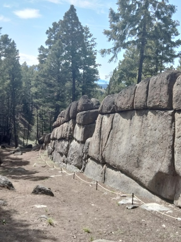
Sage Wall is a possible megalithic site near Butte, Montana. In this post, I am going to thoroughly embarrass my geologist husband by saying that Sage Wall looks manmade to me. But first, how did I come to visit Sage Wall in person?

Getting to Sage Wall

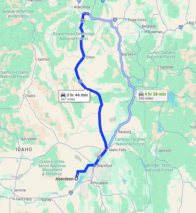
It’s on my bucket list to visit as many archeological sites as a I can, the older the better. Sage Wall was a no-brainer because it’s only a half a day’s drive from my house. It is also a good candidate to visit because looking at photos is kind of ambiguous. To really get a sense of whether it seems manmade or like a natural formation, I felt I had to be there in person.

We drove up into the beautiful Montanan Pioneer Mountains (Idaho has some as well), stayed the night in Butte, and the next day, made our way to Sage Mountain Center, where I had a reservation. We could not have asked for a more beautiful day, weather-wise. Early June in the Butte area is still basically Spring.

Chris and Linda are the property owners at Sage Mountain. About three decades ago, they wanted to move out to the middle of nowhere and build a sustainable house and retreat center. They were not looking for megaliths. Linda stumbled upon the wall on a hike one day, and Chris, who has a background in building, looked at it, said, “Yep. That doesn’t look natural. Well, let’s get back to our projects.” It wasn’t until years later, when they had established a sustainability-themed retreat center and had started to create some hiking trails for their guests, that other people started noticing the wall. Chris and Linda cleared the brush around the wall, roped it off, and had it examined by LIDAR and ground-penetrating radar.

Now, many people are coming to see the wall, seemingly to a point where it is almost becoming a problem. Sage Mountain Center is still on a wind-y, washboard-y dirt road, but now many people, seeking to get away from it all, have built new houses and cabins along that same road. Chris asked us, as we drove out, not to “go too fast past our neighbors. We’re trying not to bother them.” I got the impression that his main desire is still to just run a sustainability B&B in peace, but he’s been saddled with this danged wall.

What Would a Skeptic Say?

I want to give the skeptical geologists their due here. I think what they would say is this: “All these people who are saying Sage Wall is amazing megalithic structure are forgetting one thing: It is right in the middle of the Boulder Batholith! There are big granite rocks everywhere!”

source: formontana.net

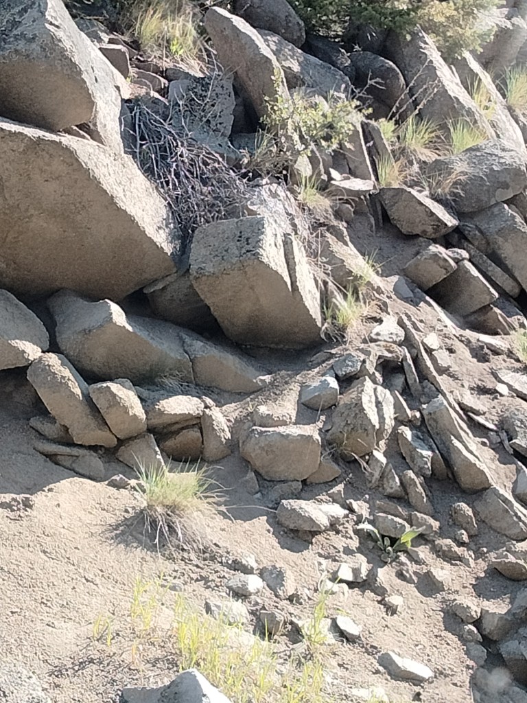
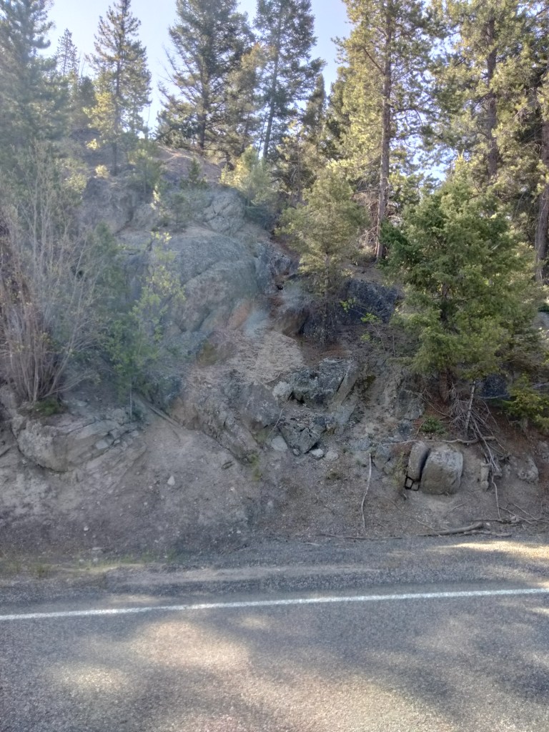
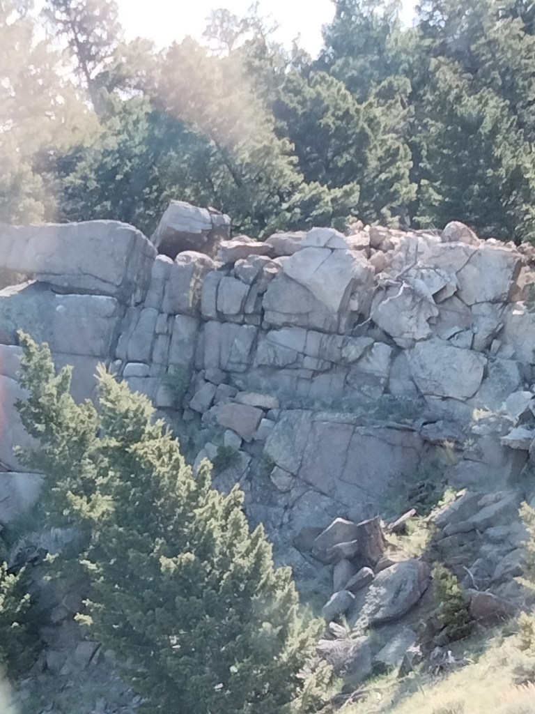
They are not wrong. The mountains to the east of Butte, where Sage Mountain Center is located, are strewn with large granite boulders and outcroppings. These tend to fracture into shapes resembling worked blocks of stone.

Here are some pictures I took, on the way in, of natural granite outcroppings so you can see how they normally look and how they tend to fracture:

You can see that the fractures are often horizontal and strikingly block-like.

We also saw some pieces of granite that had very large quartz crystals formed in them, which stuck out like chips in a chocolate chip cookie:

And, just for fun, here’s a balanced rock:

I’m not sure whether this balanced rock is natural, but I’m leaning towards no. I’m thinking it was put there to mark the trail.

Anyway, the skeptics are correct that the presence of big, blocky rocks does not an ancient megalithic structure make. This is part of the reason I wanted to see Sage Wall myself. I did not take any videos of it, because I’m not good with video and didn’t have a script ready. But there are now many videos of Sage Wall online, including drone videos. I’ll try to embed some of them at the end of this post.

Why Sage Wall is Likely Man-Made in my Amateur Opinion

So no, the claim is not that this must be a megalithic structure because it is located somewhere that we would not expect rocks. It is definitely surrounded by rocks. However, it looks distinctly different from the more random rock outcroppings around it.

It is very long, and very straight. (The wall extends past the Sage Mountain Center property, but only their section of it has been cleared.)

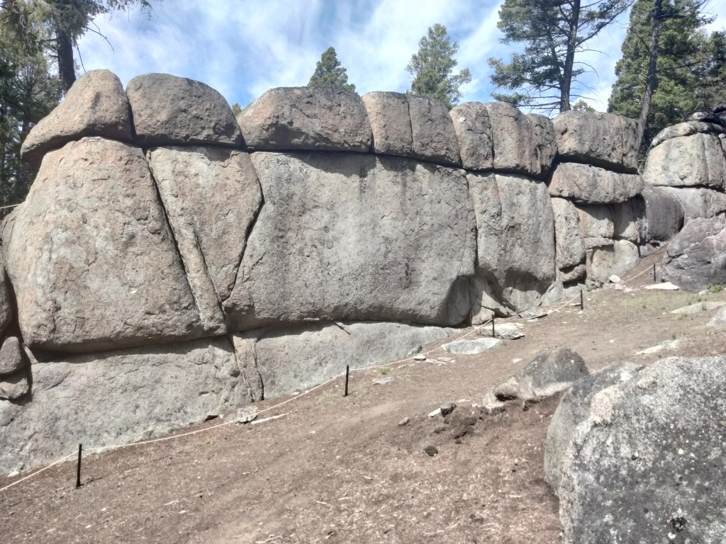
Unlike what we see with other fracturing patterns, the wall consist of very big blocks laid out in what appear to be courses. To my (again, amateur) eye, when we see natural fracturing the blocks tend to fracture into smaller pieces where they are exposed.

In the pictures above (and in the one where I’m posing), you can see a hollow lower down in the wall where a block obviously fell out.

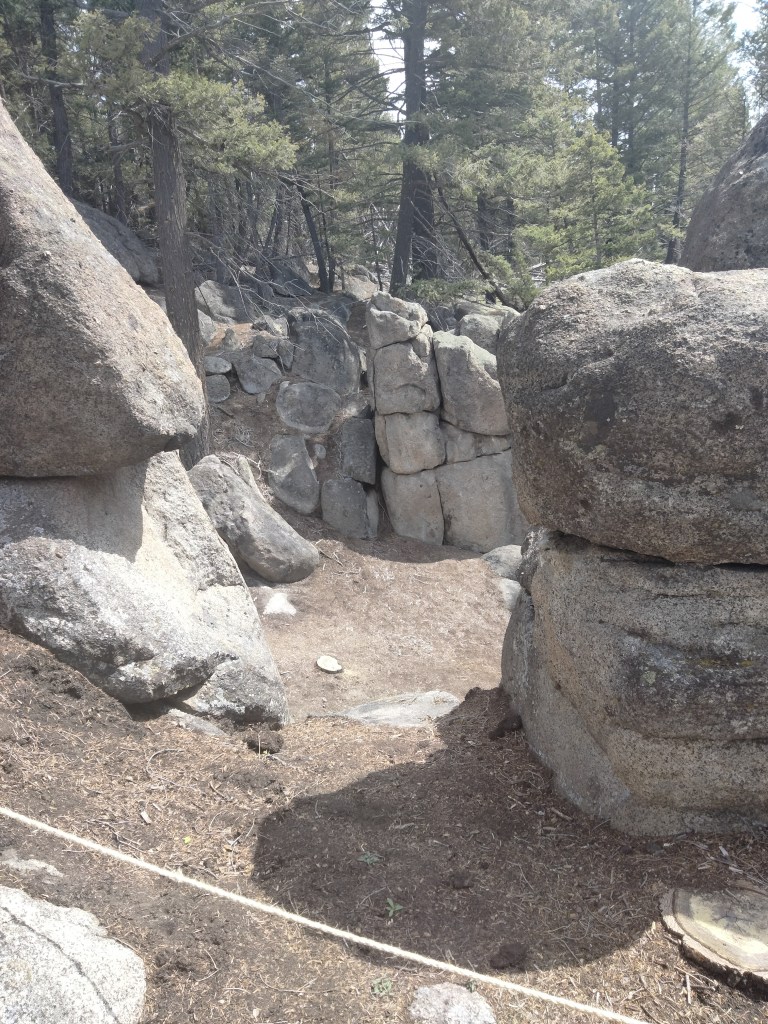
At three different places in the exposed section of the wall, there are gaps in the top similar to doors. Chris told us there had been a lot of speculation about these before researchers realized that they were simply places where boulders had fallen out. In fact, you can see the boulders below them, almost completely buried in dirt and pine duff.

On the picture above, you can also see the remains of a triangular shape. The left side of the triangle is made with shaped blocks, and the right side is incised into the megalith. The triangle happens to frame the gap where a block fell out.

According to Chris, the geophysicist who examined the wall with ground-penetrating radar found that it goes down into the ground about another 20 feet. At the bottom was something that reflected the radar, as it might be a floor or stone foundation.

All of this research is shortly to be posted on the wall’s website, here or possibly here.

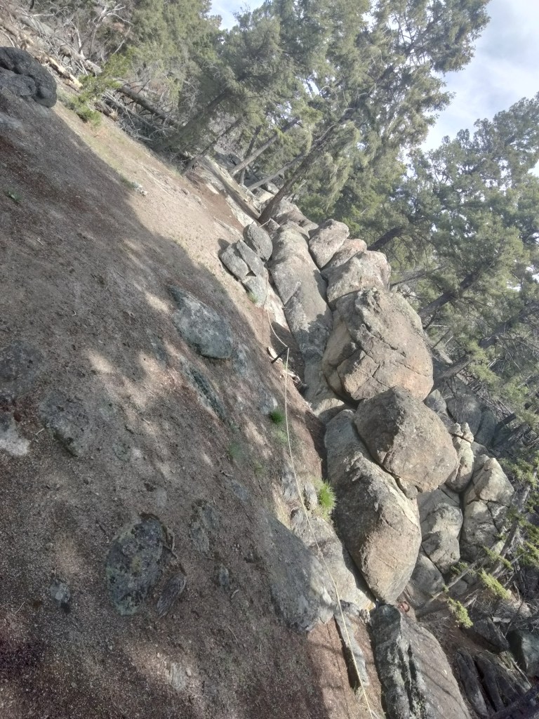
Parallel to the wall are the fallen remains of what appears to be another wall. You can see that it is “fractured” in the same way, and these other blocks also have some of the nub and cup features that we’ll talk about below.

Here’s a bit of the second wall, seen end-on.

Behind the Wall

Here’ a view behind the more intact wall. Chris and Linda have installed a rope that allows visitors to climb up behind the wall. As you can see, the wall is not just part of a cliffside, but it does have earth and rocks filled in behind, either as terraces/a retaining wall, or the ravages of time.

From behind the wall, we look out through a gap left by a fallen stone across the avenue at the remains of the second wall.

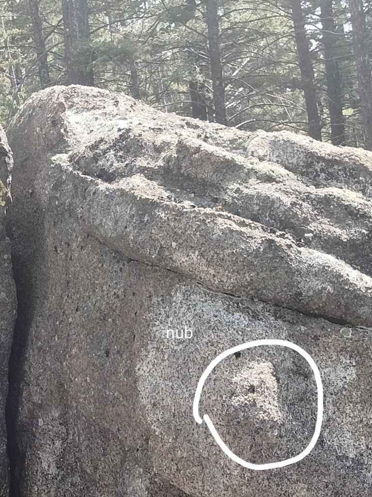
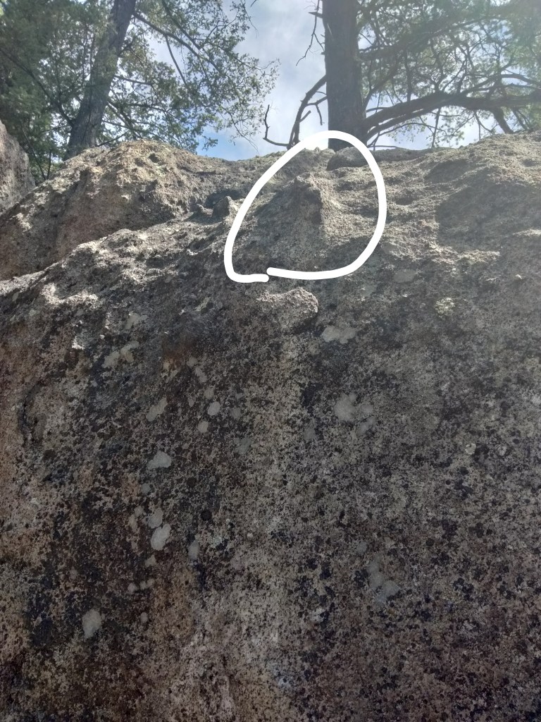
Getting close to the top of the wall allows us to see what might be nubs and cups.

Nubs and Cups

Stone nubs and cups (not necessarily corresponding to each other) are sometimes features of megalithic architecture in other parts of the world.

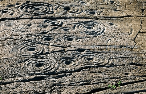
“Cup and ring” markings are apparently found all over the world, but especially in Northern Europe. Here are two articles about them.

Stone nubs or knobs are also found, especially in Incan or pre-Incan megalithic architecture.

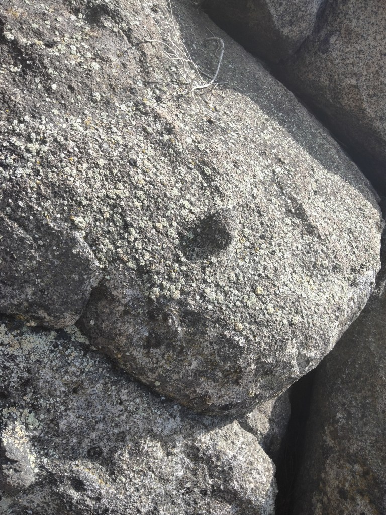
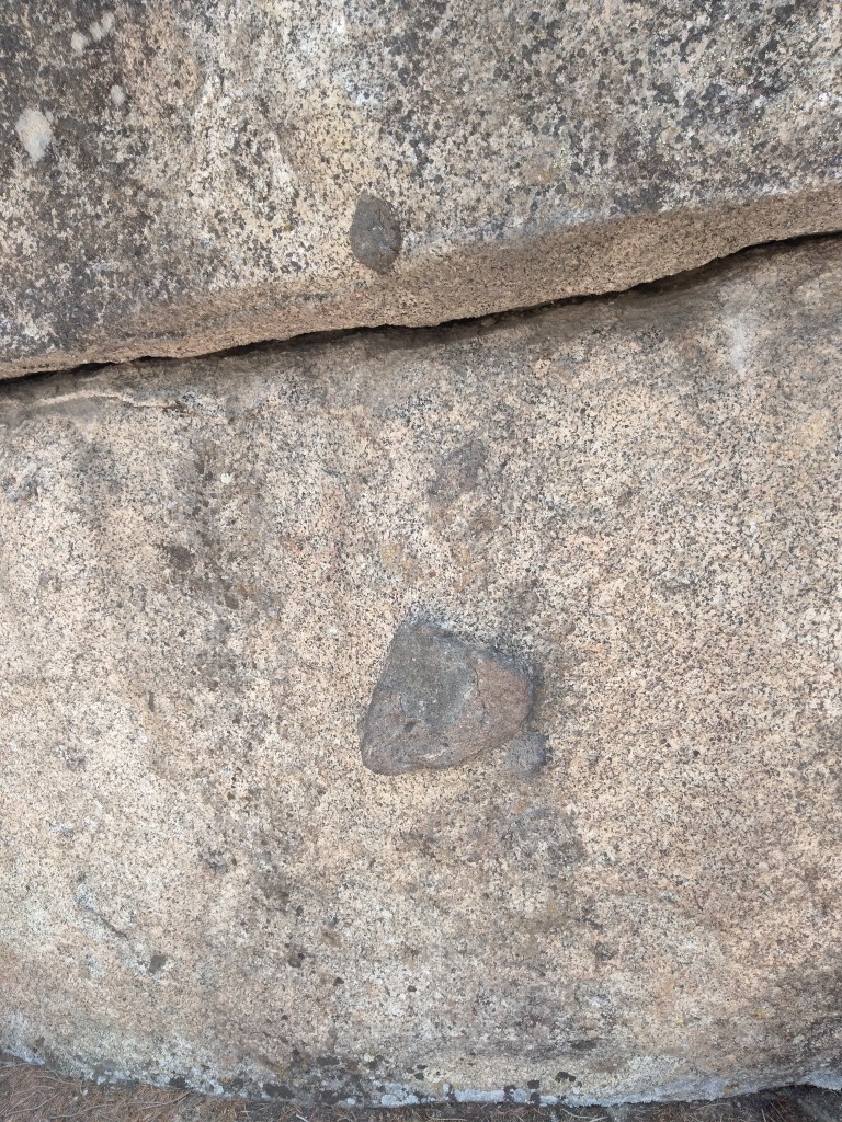
Here are some nubs found on top of the intact wall.

They are not the same as the pieces of quartz sticking out of the natural stone that we photographed earlier.

Because the wall is so weathered, some of them are not certain.

Note the possible incised lines above this last nub.

Here are some other things we saw on the back of the wall:

Incised straight line

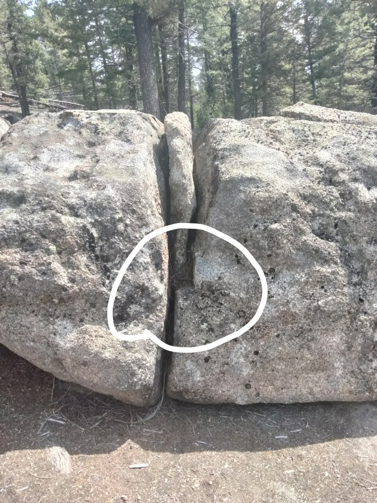
Suspiciously square fracture line

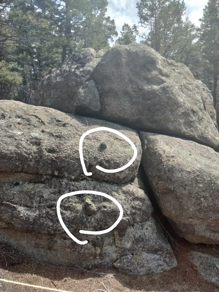
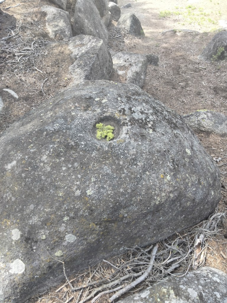
On the fallen wall as well, we found some things that look like nubs, and some possible cups. As a nod to the skeptics, yes, these “cups” do look like they could have been caused by water erosion. This would be especially true if they were found under a waterfall or a persistent drip, which they are not, as far as I can see. Some of them are also suspiciously round.

Very round “cup” in which someone has placed some fresh lichen

Some also have very straight lines incised near them. My son suggested they could be a water feature.

Looks like a cup with a spout

False Nub Alarm? Or Another Part of the Complex?

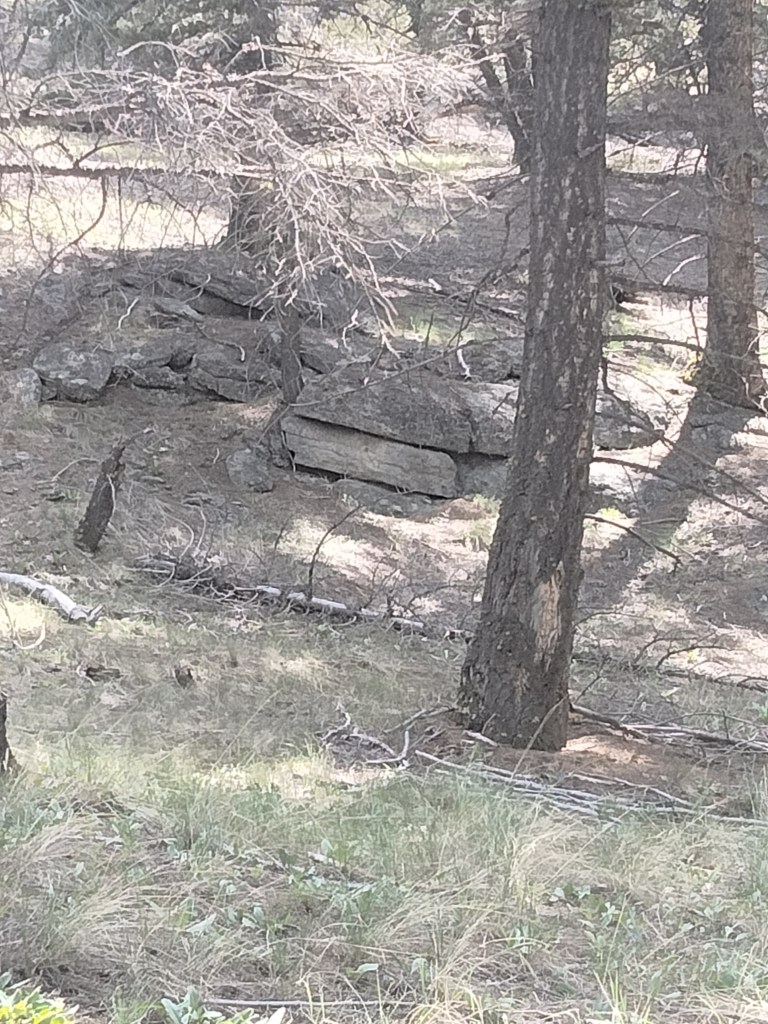
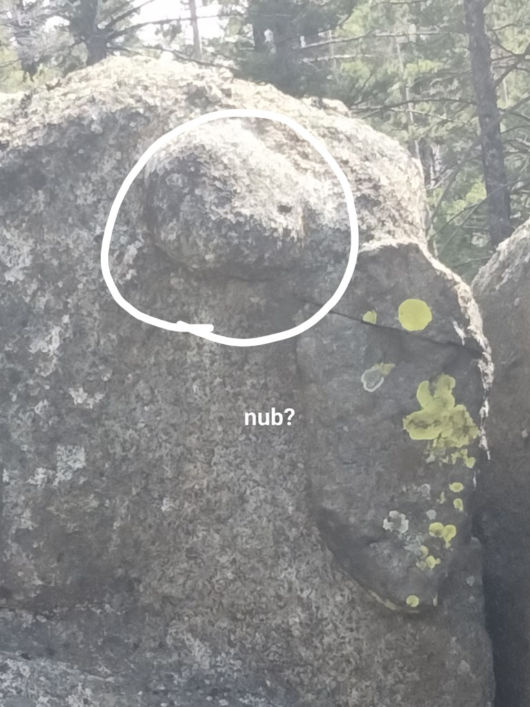
As we hiked away from Sage Wall, I took care to photograph natural rock formations for comparison. Not very far from the walls, I saw something that also looked like nubs.

Did this mean that such nubs are a natural feature of the way granite weathers? Or could this be another part of the same complex as the wall? The formation on which I spotted these nubs certainly looks like the remains of a constructed passage.

A Post-Flood Megalithic Culture

After I left Sage Wall, my husband asked, humoring me, what I thought its purpose had been. My answer is that I have no idea. It is way too old, weathered, and partially buried for me to speculate. (This does not bother Julie Ryder over at Montana Megaliths, so if you want to see some people speculate very confidently, you can visit there.)

What I can say is that, granted this is not a natural formation, it most reminds me of Sacsahuayman and other sites in Peru. You have the same dry stone construction with megalithic blocks that are shaped, but are not in uniform sizes or in a regular pattern. And, of course, you have the nubs. As for scale, it appears that if Sage Wall were excavated down to its foundation, it would be thirty or forty feet high.

Another similarity is that both Sage Wall and the Incan or pre-Incan complexes are built at very high elevations (the Continental Divide runs near Butte).

This suggests to me that they partake of the same culture area.

Sage Wall, of course, has been abandoned much longer than any of the impressive Incan complexes, some of which Europeans got to witness still in use. Consequently, it’s much more weathered, run down, and filled in. But it looks like the same sort of thing.

So, it appears that Sage Wall and any other structures we might find in association with it were built by a group of people who knew how to build with megaliths, and who then had to abandon this site for some reason. It was before recorded history in North America, but that doesn’t mean it was before recorded history was happening elsewhere. Then, they or their descendants or people who partook of the same megalithic culture, moved on towards South America and continued their building there.

I believe there is plenty of evidence–not from Sage Wall, but from other sources–that human dispersion happened very quickly after the Flood, and that when people spread out, they took a megalithic culture with them. Dolmens, pyramids, cities, and inexplicable megaliths have been discovered all over the world. In many cases, as with the Bosnian pyramids, they have been abandoned for so long that they are not immediately recognizable as the work of human hands. You have to know what you are looking at before you can see it. The Bosnian pyramids, first thought to be extremely regular hills, were confirmed as artifacts only when a team dug into them and found tunnels. It looks like something similar happened with Sage Wall.

Immediately after the Flood, the earth would have entered an Ice Age. The climate was in a tailspin: temperatures were low, precipitation at an all-time high. Much of that precipitation quickly got locked up in glaciers. Sea levels fell around the newly configured continents. There were land bridges all over: in Beringia, in Doggerland, in Sundaland. People took advantage of all this newly revealed, very humid land and scattered. But the Ice Age was short, and as glaciers melted, there were sudden catastrophic local floods. People had to abandon their sites. Many of their cities, camps, and settlements are now hidden under water along our coasts. In some cases, such as Gobeklitepe and the Vinca cities, they burned, buried, or otherwise destroyed their sites before moving on. Some of these sites might have been built very quickly and inhabited for only a short time before they were abandoned. Other things being equal, archaeologists tend to overestimate how long it took to build something, and how long ago it appeared. But even very recent sites can be quite mysterious. They have had trouble re-constructing Woodstock, for example.

How Did They Build It?

I don’t know. Obviously they were purty smart. Probably an argument is going to be made that Sage Wall must be a natural formation because “we know” that people in the Stone Age didn’t have the ability to make things like this, despite constant evidence being discovered to the contrary. Or they will argue that “we know” that there were no advanced civilizations in North America, despite Sage Wall itself. Such arguments tend to be self-re-enforcing.

I do know that we do not, currently, have the ability to build with megaliths … at least, not so easily that we consider them our first choice in building material. We might make a monument or a gravestone, but we wouldn’t attempt to build an entire house or city out of megaliths. The effort would just not be worth it. This suggests that the ancients may have had ways that were easier than our current methods.

It is worth noting that there is a well-established oral tradition of giants living in North America. There have also been giant skeletons discovered. In Peru, meanwhile, there is the tradition of the Viracochas, bearded, godlike culture-bringers. No, I’m not suggesting aliens. I do think we should take a closer look at the worldwide oral traditions of apocalypses, floods, gods, and giants, and that we should pay attention to myths that suggest that civilizations were “advanced” right from the beginning. If you want to dig into this more than you already have (and if you are reading this, I assume you already have!), please feel free to look at my page The Research Behind the Books for a suggested reading list.

Embedded YouTube Video about Sage Wall

Megalithic Ruins in Montana

Deep in Montana’s remote wilderness lies the Sage Wall, a stunning megalithic structure composed of massive granite blocks intricately stacked in a straight line extending 275 feet (84 meters). Reaching up to 25 feet (8 meters) high, with some blocks weighing 91 tons, it is believed that the wall continues an additional 15 feet underground. This unique formation appears to have precise, interlocking stones resembling ancient masonry found worldwide.

Despite its remarkable features, the Sage Wall remained hidden for centuries, covered by dense foliage on private land owned by Christopher Borton and Linda Welsh. Its discovery occurred when the landowners cleared their heavily forested property, revealing the wall and sparking scientific interest.

These paragraphs are taken from the article linked below:

It turns out that I have been sitting practically on the doorstep of a potential bucket list item!

If I had money and could travel, my destinations would be all the remarkable archeological sites in the world, particularly the ones that seem to partake of what appears to have been a worldwide megalithic culture. As I have pointed out before on this very blog, new examples of these are discovered almost yearly. Anyway, this site in Montana is one that I could actually be in a position to check out.

There are other sites in Montana that some believe are intentionally erected dolmens, and others believe are natural rock formations. Sage Wall, if it really is as it appears in the picture above, looks suspiciously manmade and highly similar to sites such as Sacsayhuaman in Peru. However, I realize that anyone who takes it as a given that there was never an ancient megalithic culture in North America will argue that Sage Wall is just a natural formation, and that rock does sometimes tend to fracture this way, as demonstrated by formations like Sage Wall.

The best way to deal with this is to see it in person.

Here’s how you do that:

Hundreds of Thousands of Ancient Stone Structures in Saudi Arabia

On Oct. 17, Live Science published an article describing a highly unusual type of site – called gates in the Harret Khaybar area, that my colleagues and I had systematically catalogued and mapped and were to publish in the scientific literature in November. That sparked immediate and extensive international media coverage, including features in The New York Times, Newsweek and the National Geographic Education Blog. Four days after the article was published on Live Science, I got an invitation from publication from the Royal Commission for Al-Ula, in northwest Saudi Arabia, to visit that town. The Al-Ula oasis is famous for hosting the remains of a succession of early cultures and more recent civilizations, all strewn thickly among its 2 million-plus date palms. As a Roman archaeologist, I had known this oasis for over 40 years as the location of Madain Salih, Al-Hijr — ancient Hegra, a world-class Nabataean site adopted by UNESCO.

Four days after the invitation from the Royal Commission, my colleague Don Boyer, a geologist who now works in archaeology, and I were on our way to Riyadh. Almost immediately, on Oct. 27 to Oct. 29, we began three days of flying in the helicopter of the Royal Commission. In total, we flew for 15 hours and took almost 6,000 photographs of about 200 sites of all kinds — but mainly the stone structures in the two harrat.

Though we didn’t have much notice, Boyer and I spent three days before our visit looking over the sites we had “pinned” and catalogued using Google Earth over several years. We then, relatively easily, planned where we wanted to fly in order to capture several thousand structures in these two lava fields. Our helicopter survey was probably the first systematic aerial reconnaissance for archaeology ever carried out in Saudi Arabia. It was possible only because of the publication of the Live Science feature article describing my research on the gate structures, and the resulting international media coverage, which caught the attention of the Royal Commission.

-Prof. David Kennedy, in this LiveScience article, November 2017

I am just so excited about this, people. Just so excited.

I had heard that there were large stone structures, called “gates,” in Saudi Arabia. I’d even blogged about it before. But I had no idea that there were hundreds of thousands. Hundreds of thousands. Saudi Arabia must be simply covered in these things.

It gets better. Guesses are that they date back 7,000 years (pre-Flood? Immediately post-Flood?). We know because many of them have been covered by lava flows in the interim. The Bedouins say they are “the works of the old men.”

It gets better. Why was the extent of these structures previously unknown? Must be racism, right? Evil European archaeologists didn’t expect the ancient inhabitants of Saudi Arabia to have built stuff like this?

Why, no. These structures are waaay out in the desert, known only to the locals. Almost impossible to find on foot. They are best surveyed from the air. Well, shortly after the last two World Wars (when small planes first came into general use), the Arab states started to achieve their independence from Britain and France. And they became closed states. They didn’t want anybody flying over their land. So, these amazing structures have been unknown and underappreciated, because those archaeologists who were interested, weren’t allowed to observe them.

So, let’s review. This story simply has everything guaranteed to make Out of Babel squirm with joy. Old, mysterious structures, really old, pre-dating even the amazing Nabatean civilization (the folks who built Petra), HUNDREDS OF THOUSANDS of them, purpose unknown, not generally known to exist because of remote location and closed country. Not only would this make a great movie, but it is the kind of thing that is continually popping up all over the world. Apparently, there is literally tons of evidence of smart humans building advanced civilizations, in just about every country on earth, yet we moderns have been unaware of this for a variety of reasons. Some of these reasons weren’t our fault (how were we supposed to know?), some were (we were blinded by the evolutionary narrative that says prehistoric people weren’t “advanced”).

When I say “advanced civilizations,” I mean a variety of different things by that. I mean cities with sophisticated water systems like Teohihuacan, observatory/computers like Stonehenge, observatory/cities like Poverty Point, temples using advanced geometry like Gobekli Tepe, pyramids like the ones in Bosnia, giant geoglyphs like the Nazca Lines and Serpent Mound and, apparently, these Saudi Arabian gate things. I also mean stones that appear to have been drilled, or precisely molded like the ones at Puma Punku.

If you have time, please follow the link and look up the LiveScience article. It’s worth reading the whole thing, and includes a video with views of the structures from an airplane.

A Retired French Mining CEO and His Theory that Doggerland was Atlantis

Some day, we are going to have to do a long post about Doggerland. Right now is a busy time of year, so I don’t have the time for that at the moment, but long story short, Doggerland has everything.

Doggerland was an area that you probably know as “the bottom of the North Sea.” Apparently, there is a shallow area there, with evidence that when sea levels were lower, it was once not only exposed but inhabited. This vast area of land would have joined England and Ireland to what is now Holland and Denmark. The proximity to Holland, plus the theory that Doggerland is the setting for The Lord of the Rings, are what I mean when I say this place has everything.

For now, let’s put a pin in this article. Jean Deruelle, the French guy with the theory, has detailed ideas about exactly what the inhabitants of Doggerland got up to. He assumes (reasonably, I think) that they were part of the Old European megalithic culture. The article also includes lots of cool speculative maps of Doggerland in various stages of submersion by the sea. We can argue about the exact timing of it all, later.

What Is A Tell?

A tell is, essentially, a man-made hill that consists of layers upon layers of ancient ruins.

I first heard about tells in a Biblical Archaeology context. The Levant is filled with tells. Often, the original city was built on a high spot to begin with. Then, as successive generations of the city were destroyed and rebuilt, the tell got higher and higher. In the Levant, you often find a current city still thriving on top of the tell. So there is a modern city on top of a medieval city on top of a Greco-Roman city top of an Israelite city on top of a Canaanite city on top of a city from the time of Sumer. If you dig down carefully through these tells, you will find mosaics, pots, coins, garbage, all kinds of good stuff. Tells are different from grave mounds because they don’t usually contain grave goods carefully selected, but rather the debris of everyday life, and often the ash layers of past battles.

Well, it turns out, the Levant ain’t the only place that gots tells! I am currently reading The Civilization of the Goddess: The World of Old Europe, by Marija Gimbutas, published in 1991. As you can tell (haha!) from the title, Gimbutas has her own spin on the history of Old Europe, about which I will no doubt post later. But today, I am just here to talk about tells. There are many tells in Thessaly, Macedonia, Bulgaria, Yugoslavia, Romania, western Ukraine and southern Hungary (as we call them today) which show that in the 6,000 to 4,000s B.C., the Balkans were a happenin’ place. They revealed tidy planned cities, sometimes of a few thousand people, with hearths, idols, loom weights, and “exquisite” pots. (I love it when archeologists call something like a pot “exquisite.” It means they are really excited about it.)

I have previously posted about the Vinca Signs, which came from this culture area and may have been an alphabet, though Gimbutas looks like she’s gearing up to treat them as primarily religious symbols. The settlements in this area are all fairly uniform, especially in their earlier stages, which says to me that people spread out quickly, probably from the Levant via Turkey and Macedonia. The climate at the time was rainier than now, which made farming easier. The sea levels were probably also lower, which might have facilitated travel.

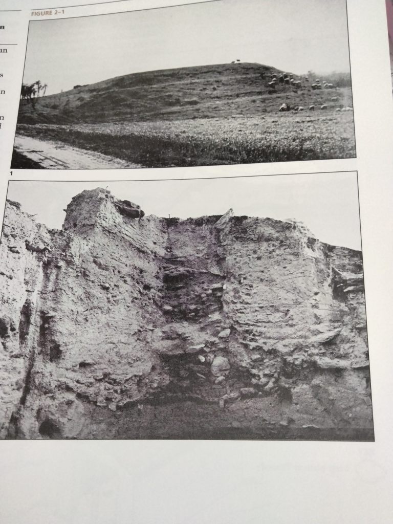
Take a look at the photo at the top of this post. It comes from page 13 of Gimbutas’ book. The upper image is labeled “Argisa tell, west of Larisa, Thessaly.” The lower one: “Profile of Sesklo tell, c. 12 m of cultural deposits, with Early Neolithic (Early Ceramic) at the base and classical Sesklo on the top, c. 65th – 57th cents. B.C.”

Twelve meters of cultural deposits! Imagine the riches.

At the time this book was published, a few tells in the Balkan area had been excavated (Sesklo by Gimbutas herself), but most had not. I expect that is still true today. There have been some “hills” in Bosnia that turned out to be pyramids and to have tunnels inside, but really, even archeologists like Gimbutas who realize that Old Europe was much more advanced than previously thought are just getting started. I doubt that everything will be excavated, or the ancient story fully told, in this life. But if you have any interest in such things at all, it’s amazing to think of all the wealth of all those tells sitting there with their meters and meters of secrets.

Exquisite.

The Human Impulse to Make Stone Spheres for Some Reason

A while back, I blogged about decorative, marble-sized clay spheres that were found at the Poverty Point archaeological site (“Poverty Point objects”), which turned out to have been used for cooking.

That’s what I thought I had stumbled upon when I first saw this headline about the larger, billiard-ball sized stone spheres that have been found in association with recumbent stone circles in Scotland.

But these spheres turn out to be, if possible, more sophisticated than the Poverty Point objects. In this and the follow-up article, there are a number of theories about the possible purpose of the spheres:

  • Projectiles for hunting or war. However, the spheres don’t appear to have taken any damage from being thrown.
  • Perhaps the small spheres were used to roll the megaliths, though again, if they are not damaged this seems unlikely (and for the record, I think this is a dumb theory).
  • Fishing weights
  • Weights and measures for other purposes, since some of them seem very standardized.
  • Divination, by rolling them on the ground.
  • The stones were used to roll around in a bowl of sand and produce interesting sand art. (Hmmm.)
  • Representations of pollen, or of atoms. (See my post that points out that the caduceus may be a representation of a DNA molecule.)
  • The spheres may have been a “portfolio” made by skilled stoneworkers in order to demonstrate what they were capable of. (Now we are getting somewhere!) In connection with this, the author of the article mentions that he has seen at least one stone sphere (and spirals) reminiscent of those in Scotland, while on a trip to a pyramid site in Bolivia. He asks, “Did the megalithic Scottish stonemasons really make their way to South America in prehistory?” That is certainly possible, but I think it could simply speak to a worldwide, pre-Flood or immediately post-Flood culture of megaliths, pyramids, and advanced knowledge of astronomy.
  • The spheres could be models of the Platonic Solids. “What we have are objects clearly indicative of a degree of mathematical ability so far denied to Neolithic man by any archaeologist or mathematical historian.”
  • Given their sophisticated geometry, the author of the article favors the idea that these spheres were used in the study of spherical geometry. This leads on to the suggestion that they could have been models used to study the geometry of the earth, perhaps for navigation, astronomy, or detecting ley lines. Regarding navigation, see the Out of Babel posts on the Antikythera Mechanism, and possible ancient maps. Regarding astronomy, recall that in the more recent ancient world, the celestial equator, equinoxes, and the procession of the stars were conceived of as a structure of intersecting hoops surrounding the earth.
  • Finally, there’s a theory that the spheres were used as “energy channels” to focus magnetic properties either into fields for increased soil fertility, or into human bodies for healing. This one seems to me a little weird and unnecessary because I like the spherical geometry thought … but I hesitate to mock it too hard, because quite a few very weird ideas that I would at first dismiss, have turned out to have been at least widely accepted in the ancient world, if not actually functional in the ancient world though not in the modern world.

Long story short, add one more tick mark to the column “ancient people were not only much smarter than we think, but also much smarter than we are now” … which has been a constant drum beat on this blog.

I started out studying the ancient world so that I could write fiction about it. I still enjoy doing that, but the more I learn, the more I realize that my fiction is going to be very inaccurate because I truly have no idea what those people were getting up to back then, and it seems that even if I had been present, I would hardly have been capable of understanding it.

But buy my books anyway.

Very Old Pyramids in Peru

The sacred city of Caral-Supe

Random thoughts:

  • The dates, as always, are messed up and questionably to be trusted. For example, the idea that the step pyramid at Saqqara is the oldest known pyramid in ancient Egypt.
  • Still, Caral-Supe seems to be old and I’ll accept that it was the region’s “mother culture.”
  • “The design of both the architectural and spatial components of the city is masterful, and the monumental platform mounds and recessed circular courts are powerful and influential expressions of a consolidated state.” Also, “Archaeologists think the sites collectively reflect the Americas’ earliest core of civilization, which existed from 3000 to 1800 B.C. and was totally uninfluenced by outside factors.” Both cannot be true. Given that it is a sophisticated city-state centered around pyramidal temples, it seems have been an expression of the ancient, pagan bureaucratic urban human culture. Triangulating with genetic evidence, it was probably carried to Peru across the Pacific when humanity was dispersing after the Flood.
  • “No trace of warfare has been found at Caral: no battlements, no weapons, no mutilated bodies. Findings suggest it was a gentle society, built on commerce and pleasure.” That’s a nice thought, but I’m withholding judgement. The same thing was said about the Maya until we got better at interpreting their inscriptions, and started finding pictures of gruesome human sacrifice, piles of bones, etc. As Caral-Supe is much older than the Mayan civilization, the traces of warfare might be even harder to find.