Poverty Point: Star of My Show

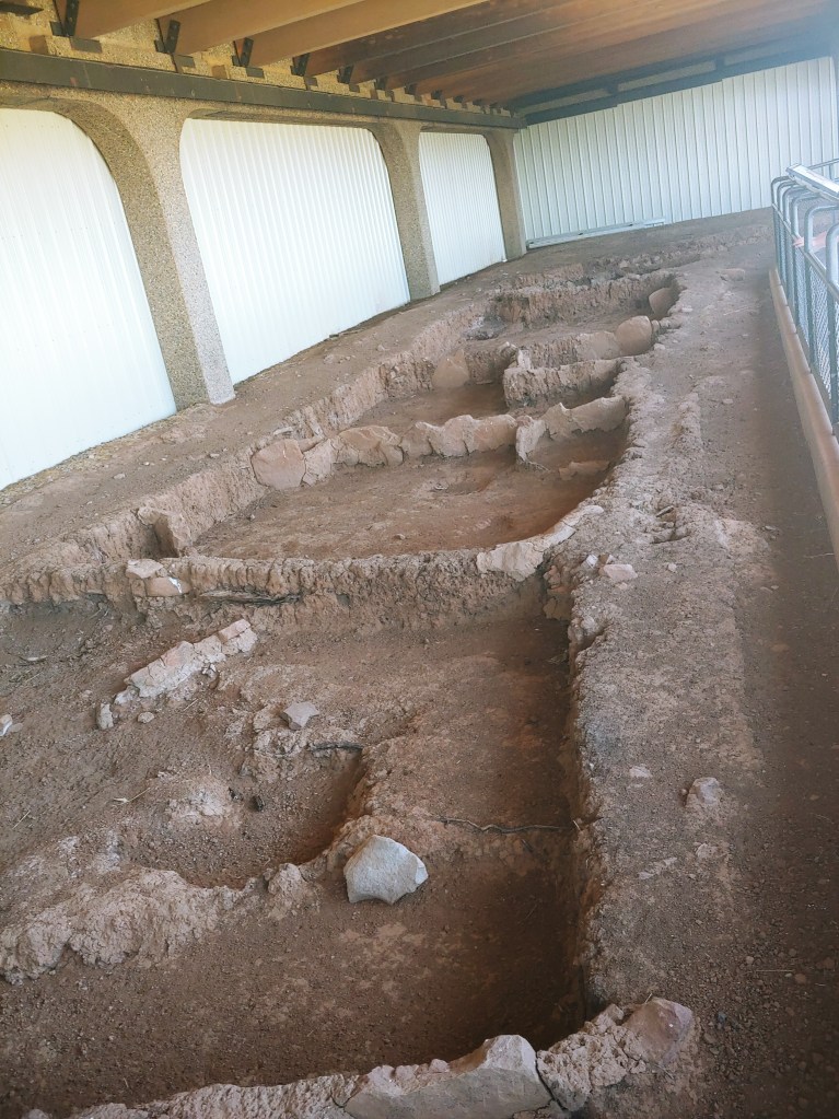
Near Bayou Macon, Louisiana, is an archaeological site called Poverty Point. I am drawing for information about Poverty Point primarily on the book Mysteries of the Ancient Americas, 1986, by the The Reader’s Digest Association Inc., but here is the official Poverty Point web site. It is now a World Heritage Site. Here is a recent article about an archaeological project done at Poverty Point.

First, the Obligatory Eye-Rolling at Mainstream Archaeology

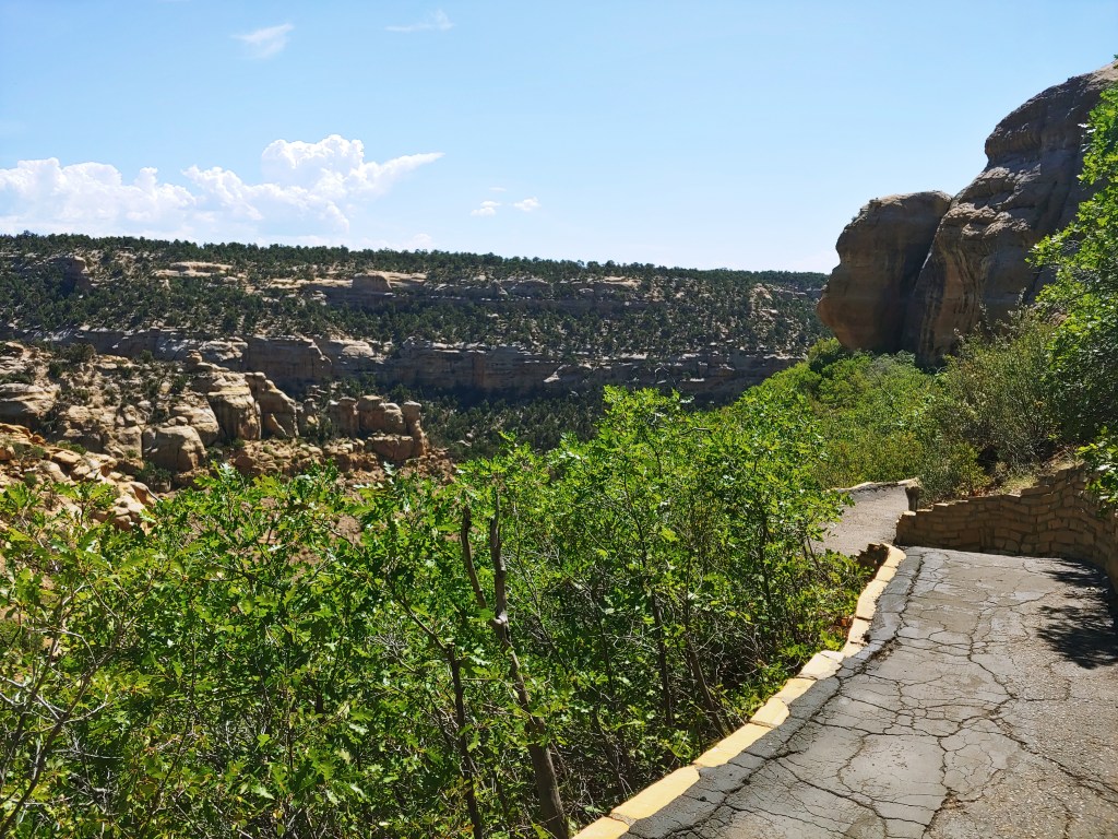
Like many North American sites, Poverty Point was hard to spot because it consists of earthworks that had been overgrown with forest. (And not only North American sites. Radar technology is revealing that the Mayan civilization was much more extensive than first thought — because the jungle took over so quickly — and is also revealing old settlements in what was hitherto thought to be never-before-settled Amazon rainforest.)

Earthworks are basically impossible to date, but for other reasons, Poverty Point is thought to be about 3,000 years old (i.e. about 1,000 B.C.). However, it helps to remember that when dealing with paleontology and even archaeology, dates are often basically just made up — i.e. reached through dead reckoning based on a shaky framework of background assumptions. But let’s accept 1,000 B.C. for now.

Mysteries, which again, was published in 1986, also makes several more or less dubious claims about the builders of Poverty Point. Here’s a sampling:

“[S]cholars think it is doubtful that societies on the chiefdom level existed in North America 3,000 years ago.” (page 111)

“[This civilization] had no writing, no true agriculture, and no architecture except for its earthworks. Its weapons were simple: the spear, the atlatl, the dart, the knife, and possibly the bola. Even the bow and arrow was unknown to these people.” (page 112)

“Considering the massiveness of Poverty Point’s ridges and mounds, one naturally assumes that they were built over many generations or even centuries.” (page 112)

Mysteries of the Ancient Americas

The first of these quotes is 100% pure assumption, based on the noble savage mythology so beloved of modern academics.

The second is also pure assumption. A better way to put it would be that we have found no evidence of writing, agriculture, etc., so far. The findings reported at the first link above seem to confirm that agriculture was not a big thing at Poverty Point, based on the remains of the peoples’ diet, but this could have been simply because the fishing and foraging was so abundant. It does not necessarily mean they were “only hunter-gatherers” who had not “advanced” to the level of agriculture. C.f. similar claims being made about Gobekli Tepe. As for the bow and arrow, I take it that remnants of all these other weapons have been found, but not bows. Even that, I take with a grain of salt, as it seems that almost every week, something is discovered that we had thought this or that ancient group didn’t have. (Here’s the latest example, which even refers to ancient humans as not particularly ‘smart,’ with ‘smart’ in scare quotes.) But even if the Poverty Point people did not use bows and arrows, this does not necessarily mean the weapon was “unknown” to them. Perhaps they had specialized in other weapons instead. Not everybody in the Middle Ages was an English longbowman, but boy oh boy did they know about them!

Finally, the third claim made in the Mysteries quote box (which they at least had the grace to call an assumption), appears to have been possibly disproven by the second link above. “New radiocarbon dating, microscopic analysis of soil, and magnetic measurements of soils at Ridge West 3 found no evidence of weathering between layers of soil, suggesting that the earthwork had been built rapidly.”

Now, the Site Itself

from Mysteries of the Ancient Americas, p. 111

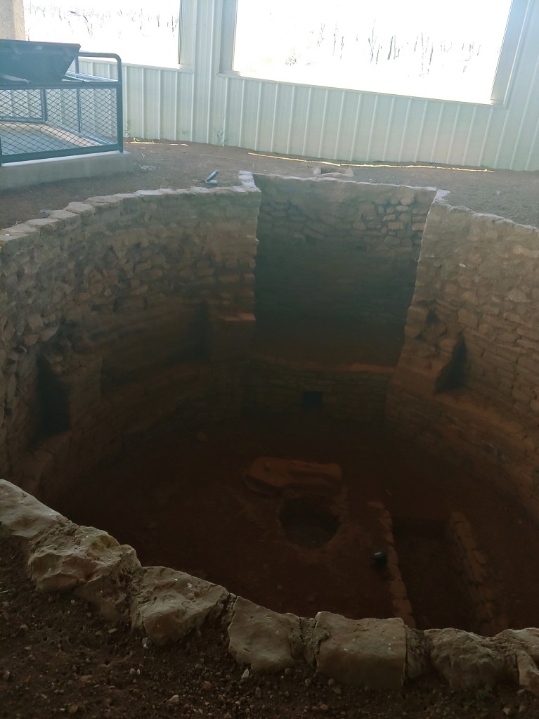
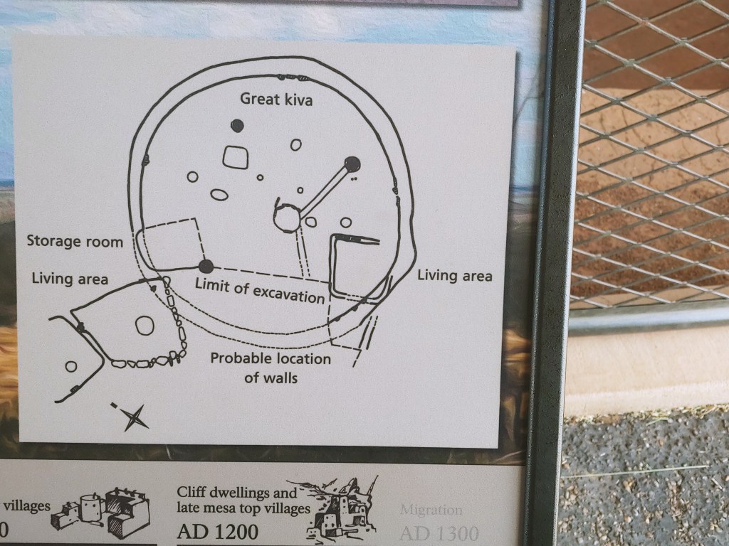
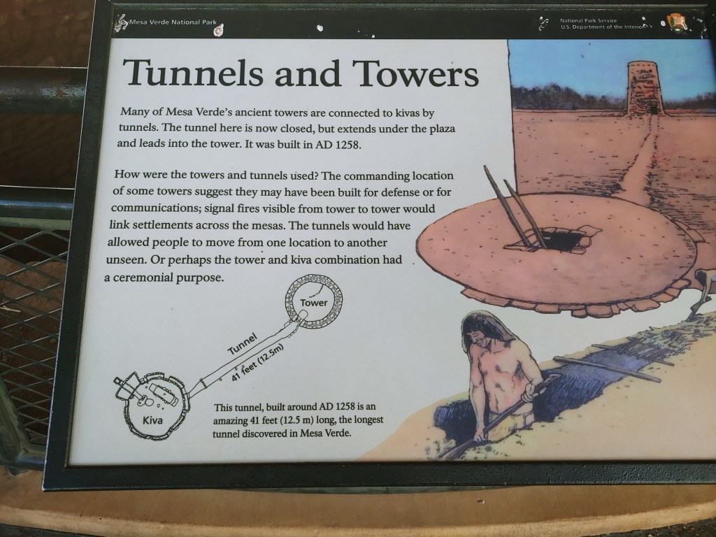
It’s easier to just show you guys this diagram than to try to describe it, but buckle up, here comes the description. The Poverty Point site consists of earthen ridges set concentrically inside each other, in what looks like a C-shape from the air. “The two central aisles point toward the setting sun at solstice” (ibid). Directly to the west of all this is a large man-made mound (Mound A), while a ways farther north there is a smaller mound (Mound B), which seems to be a burial mound. Bayou Macon, directly to the east, cuts through the eastern side of this whole complex. Was this whole thing originally C-shaped, or was it a circle? Probably a C shape, because there are similar, smaller sites around this region which tend to be “constructed in a semicircle or semioval pattern with the open side facing the water and with one or more mounds located nearby.” (ibid)

The book uses the word “ceremonial” a lot, and honestly I can’t fault them. This complex was constructed by human beings, and now, millennia (?) later, more human beings come and look at it and say, “This looks like it was clearly designed for ceremonial purposes.” That’s a valid argument. The architecture is having a certain effect on us, and we can assume that it had that same effect on our long-lost fellows, and was designed to.

Poverty-Point-related sites have yielded thousands of little decorated clay balls, called Poverty Point objects, that we think were used for cooking. There are also little clay sculptures of female torsos (with or without heads), reminiscent of the Venuses found around ancient Europe. There are also “myriads of stone tools,” including drills, awls, and needles, made both from local stone and from flint imported from as far away as Indiana. They made “plummets,” perhaps as bola weights or perhaps as weights for fishnets, “most often of hematite in graceful teardrop or oval shapes [and] often decorated with beautifully executed stylized designs representing serpents, owls, and human figures.” (ibid, p. 115)

But it is in lapidary work that the Poverty Point people excelled. Pendants, buttons, beads, and small tablets are worked in an array of such colored or translucent stones as red jasper, amethyst, feldspar, red and green talc, galena, quartz, and limonite. Most of these stones were obtained by far-flung trade. Among the pendants are a number of bird effigies — red jasper owls and parakeets, and bird heads worked in polished jasper and brown and black stones. There are also representations of a human face, a turtle, claws, and rattles, and stubby but carefully made tubular pipes.

Mysteries of the Ancient Americas, p. 115

O.K., I’ve changed my mind. Perhaps this C-shaped complex was not ceremonial, it was a lapidary factory.

Regardless, the Poverty Point “hunter-gatherers” have once again made my point for me: that wherever human beings go, they start up civilization and display mathematics, art, and craftsmanship.

The Snake City

I guess there have been a lot of “snake cities” throughout history. In my third novel, The Great Snake (upcoming, hopefully in 2022), Snake City is founded by a small group who break off from our main group of characters. Their city is like a smaller, less populous version of Poverty Point.

As you can see, our city is much smaller. It overlooks the Mississippi River itself, rather than a bayou. The temple is built not on a man-made mound, but on a natural hill. The people actually live on top of the ridges. They aren’t lapidary craftspeople (at least, not as of the end of the novel). And, finally, this city is about 7,000 years earlier in time than Poverty Point. Other than that, though, it’s exactly the same.

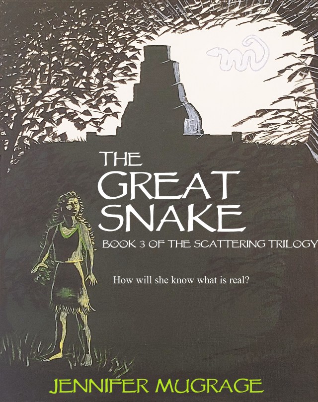
In the cover image, Klee is standing on the lower hill that houses the women’s complex. Behind her, the temple looms over her from atop the hill. It has a Mayan-style roof comb that is facing away from the viewer. In this view, the snake is either hovering in the air just east of the temple, or possibly it is out over the river.

Review: People of the Silence

Husband-and-wife team W. Michael Gear and Kathleen O’Neal Gear write thoroughly researched novels about the different people groups living in North America in pre-Columbian times. This one, about the Anasazi or Pueblo Indian ancestors, is actually set in about 1150 A.D. This culture is “prehistoric” only in the sense that we don’t have a formal, written record of everything that went down, although there is plenty of archaeological evidence and oral tradition.

A Ceremonial City

This book comes with three maps. (I love me some maps!) The first shows North America with the general locations of the people groups who will come into play in the novel: “The Tower Builders,” “The Straight Path People,” the Mogollon, and the Hohokam. A second shows the Four Corners region, including Mesa Verde and Chaco Canyon, New Mexico, where most of the action in this book takes place, including the Great South Road built by the Anasazi and the Straight Path People’s names for all the surrounding features. I flipped back to this map many times throughout the course of the book. A third map shows a closeup of Chaco Canyon, or as the characters call it, Straight Path Wash. It shows the locations of the towns there. These can still be seen today, but the authors have given them names that the ancient Pueblo Indians might have used, such as Talon Town, Starburst Town, etc.

Talon Town (the book’s name for what is now called Pueblo Bonito in Chaco Canyon) is the capital of the Straight Path people’s civilization. It is occupied by their priest/king, the Blessed Sun; his wife, the nation’s Matron; a seer, the Sunwatcher; the nation’s War Chief; a number of warriors; and numerous slaves, mostly people captured from neighboring groups such as the Hohokam, who are there to serve these aristocrats. Talon Town produces almost no goods of its own. Food, clothing, blankets, shells, turquoise, etc. are brought in as tribute from surrounding villages over quite a wide area, or are obtained through trade. This is what the archaeological record seems to show us.

Talon Town has two large plazas, each with a kiva in it, so that it can host religious gatherings such as solstice ceremonies and funerals for important people. Here is the authors’ description of what it might have looked like inside one of the Great Kivas as a young apprentice prepares the Blessed Sun’s body for burial:

Thlatsina [=kachina] masks hung over the small wall crypts, glittering with precious stones. Thirty-six in all, they wore brilliantly colored headdresses of blue, yellow, red, and deep black feathers. Tufts of pure white eagle down crowned many masks. Neck ruffs of buffalo, badger, rabbit, and other hides gave the appearance of beards. But Poor Singer’s eyes lingered on the sharp fangs and polished beaks that glinted in the fire’s amber glow.

The circular kiva stretched at least a hundred hands across, supported by four red masonry pillars and encircled by three bench levels. Each bench had its own sacred color, yellow, red, and blue topped by white walls.

Another body rested on the opposite foot drum, covered completely by a beautiful Death Blanket. Poor Singer couldn’t guess who it might be.

People of the Silence, p. 416

Now, the Plot

Here is the review of People of the Silence I posted on Goodreads a month ago.

Some historical novels or speculative novels set in ancient times seem to cut-and-paste modern concerns onto those supposedly ancient characters. The Gears definitely don’t do that. That is one of my top concerns in historical fiction, so props to them.

It did take me a looong time to finish this. The novel starts with a steep climb through a lot of info dumps about Anasazi cosmology, including an extended vision that happens to a young man whom we haven’t gotten to know yet. All during the vision, I kept trying to figure out what the different elements in the vision represented in the cosmological scheme that had just been presented. Later, it turned out that we weren’t supposed to totally understand the vision at the time, and it would be revealed later. Perhaps, if I had read any other books by the Gears, I would have realized this sooner, but as this was my first one, I didn’t at first have that confidence.

The steep climb continues, as we are introduced to a large cast of characters. For about the first half of the novel, it wasn’t clear to me which characters, if any, I was supposed to sympathize with. In the book, the Anasazi have a brutal caste system based on “First People” and “Made People,” and slaves captured in raids on other tribes. Some of the First People later turn out to be sympathetic characters, but you don’t find that out until about halfway through the novel. Also, some characters who are supposed to be sympathetic are seen committing atrocities when we first meet them. Eventually it becomes clear that this is a very brutal society, and the prevalence and unavoidability of violence is part of the point of the novel; but again, the violence does make it hard to figure out who we are meant be to rooting for.

After the steep climb, which lasts about half the novel, we have a long plateau (a mesa top, if you will) where we are getting to know the characters and the intricate machinations taking place in their dying society. Wheels within wheels! The whole novel also includes a lot of beautiful, lyrical descriptions of the Four Corners landscape. The Gears do a great job giving you a sense of what time of day it is, what the weather and background look like, and details of what people are eating and wearing, and how they are wearing their hair. Almost every dialogue tag comes with a one-sentence description of what the character looks like at the moment (e.g. “Her greying black hair had come loose around her beautiful triangular face, which was covered in smears of reddish dust”). Stephen King would hate this, but I don’t mind it. It helps you keep track of the different characters by forming mental images of them, and it gives that much-coveted visual glimpse into what the Anasazi looked like. (For example, they dressed in bright colors, and their royalty decorated themselves with copper bells and macaw feathers.)

Finally, having scaled and then trekked across the mesa, once you are comfortable in the world and familiar with all the power dynamics, the last hundred or so pages take you on a mad, roller-coaster rush down the other side, as secrets are revealed, violence explodes, and desperate, last-minute measures are tried. This book even turned out to be a rather creepy murder mystery, with an unexpected but satisfying reveal of the murderer.

After the novel, there is an extensive bibliography of all the archaeological and anthropological sources the Gears consulted.

If you liked my book The Long Guest, you will probably like People of the Silence, and vice versa. 

This Link Has Everything

Possible shaman’s snake stick from 4,400 years ago discovered in a Finnish lake”

First of all, the tongue twister. Shaman’s snake stick. Say that five times fast! The stick was a carved wooden snake, found in a lake (stop me before I rhyme again!) or swamp, so … possibly released there on purpose?

Secondly, an adorable picture of Finns digging in the mud. They look so happy. (As anyone should when they get to dig in the mud and find archaeological artifacts.)

Thirdly, this quote: “[S]nakes are loaded with symbolic meaning in both Finno-Ugric and Sámi cosmology, and shamans were believed to be able to transform into snakes.” Add these remote people, living at the far northern edge of the world, to the long long list of the world’s peoples who find spiritual and/or cosmological significance in snakes.

This link even has a book tie-in for me! Yes, it does! The upcoming third book in my trilogy will be called The Great Snake. And yes, it has snake cosmology. And no, this is not very original, but it is based in research. TGS is not available for pre-order yet, but you can get ready for it by buying and reading The Strange Land if you haven’t already done so. TSL is where the serpent makes its debut, at least in my books.

Those Creepy Fates

Left to right: Broken Top, South Sister, North Sister

There is a trio of mountains in Oregon called the Three Sisters. In fact, the town of Sisters, OR, is named for them. In this picture, you can only see two of the them (the third is hiding behind).

I use this picture for my illustration because, while there is a lot of great art portraying the Three Fates, it’s a little hard to find a picture that I can use without copyright infringement.

I recently read, with my kids, The Black Cauldron. My imagination was captured by the three swamp-dwelling little old ladies (if human?) who guard the Cauldron: Orddu, Orwen, and Orgoch. As far as I can tell, Lloyd Alexander made up these ladies and imported them into his story. Though triple goddesses are a recurring feature in Celtic mythology, they are not really the same as the three fates and it’s even a falsehood that they always came in the form of maiden, mother, and crone, as you will see if you read the scathing 1-star reviews of the book The White Goddess by Robert Graves.

The Greek fates are named Clotho, Lachesis, and Atropos. Clotho spins the thread of a mortal’s life, Lachesis measures out its predetermined length, and Atropos cuts it. Norse cosmology also has fates, called the Norns … in some versions three, named Past, Present and Future; in some versions a large but unknown number, according to this article. Evidently the idea of fate personified as three or more women (or woman-like beings) goes way back in Indo-European cosmology. It shows up as late as Macbeth’s three witches.

I had ignored the Fates for some time (as one does); but reading The Black Cauldron made me wonder whether you can write a fantasy that draws on Indo-European cosmology and not at least tip your hat to them.

By their very nature, the Fates are creepy. Lloyd Alexander does a great job of making this feeling come through when he introduces Orddu, Orwen, and Orgoch. The heroes of the book, on first seeing the fates’ house (and by the way, the word ‘fates’ is not used), think it is abandoned because it looks so run-down and blends so well into the swamp shrubberies. There’s a loom set up inside the house, on which is a tangled mess of a weaving. (Don’t touch!) Then the ladies show up. Rather like Tom Bombadil in The Lord of the Rings, they seem cavalier about things that ordinary people regard as matters of life and death. Orddu keeps offering to turn the travelers into toads (“You’ll grow to like it”). Orgoch is excited about this because if they were toads, it’s implied she could eat them. Orgoch, the only one of the three who is clad in a black cowl, seems to want to eat everything. As Orddu says, “It’s hard to keep pets with Orgoch around.”

The three ladies light up when they hear that the travelers know Dallben, who it transpires they discovered as a foundling and raised. They refer to him as “little Dallben.” (Dallben is over 300 years old.)

The travelers stay the night in an outbuilding belonging to the three ladies. Taran, the main character, wakes up in the middle of the night and sneaks up to the window of the dilapidated cottage, which is now alight. He returns, reporting, “They’re not the same ones!” Orwen, Orddu and Orgoch now look young and beautiful, and they spend all night working on their weaving. The next morning, however, they appear looking just as they did before, and with the same apparent disregard for human life.

Lloyd Alexander has set a really high bar with this fictional, Welsh version of the fates, and I’m not even sure I could approach it. Here is an article that dives more deeply into an analysis of the fates and of all of Prydain, the fantasy world in which the book is set. Be warned, the article assumes you are familiar with the whole series.

Kiva vs. Pit House

If you can bear with me, we are going to do one more Mesa Verde post before we start mixing it up again.

As mentioned last week, when I went to Mesa Verde this July, we did not visit the famous Cliff House (which was closed), but instead the lesser-known Wetherill Mesa. Last week I showed you a smaller cliff house, called Step House, that is part of the Wetherill Mesa area. This week, I am going to show you a pit house.

Here’s part of the path to it.

The ruin sites that have been excavated on top of Wetherill Mesa have had sheds built over them that are open on one or two sides. I imagine this protects the excavated ruins, but it’s also great for the tourists. It is so hot out there in the Four Corners desert that, were these sites not shaded, no one would stop for very long to look at them. As it is, you come over the blistering trail, and that shed represents a welcome oasis of shade where you can cool down, take a breath, and then spend some time studying the ruins.

A Pit House

Here we are standing at the entrance to Badger House, viewing it through the first two anterooms, towards the inner room at the back. The inner room has a bench around the edge of it, a narrow little door leading into it, and a big slab of stone sitting right in front of that door, blocking our view in. When in use, this pit house would have had walls extending a little way up from ground level and then a roof. All of this would have been made with wood posts for the basic structure, and then adobe applied in a wattle-and-daub manner. These pit houses had the people living partially but not completely underground. This kind of housing is super practical in a desert, because it insulates the inhabitants from the wild swings of temperature that come not only seasonally, but also between day and night.

Here’s a view of the inner room of Badger House, taken from the side. As you can see, in the foreground there is a little stone closet area (for grain storage?). Opposite it, on the other side, is another stone half-wall (for privacy?). On the left, there is a line of three post-holes for wooden posts that would have helped hold up the roof. (The holes in the bench are also thought to have been put there so that wood beams could be rested in them.) The star of the show is the sunken fire-pit, with the upright slab of stone standing between it and the door that leads from the anteroom.

When I first saw this slab of stone, which seemed to me to be randomly and inconveniently placed, my thought was, “What the heck?” Then my mind immediately went to privacy for people in the inner room, or a Feng-shui type arrangement for blocking bad spirits or energy that might try to enter, or even a physical barrier to make it easier to corral pets and toddlers. But the actual explanation may be even simpler. It’s to protect the fire from drafts. I hadn’t considered this explanation at first, because I expected such a stone to be placed right next to the fire. (A Native friend once told me that if you build a fire right next to a stone, the stone will cause the smoke to draw upward.) But apparently, this is how the Anasazi people dealt with drafts. The informational posters at the site call it a “deflector stone.” If this is where they needed to deflect drafts, that also gives us clue about how the air was flowing through this pit house. The builders were aware of the need for ventilation, as we will see in a moment when we look at a kiva.

The small hole just to the left of the fire pit may be a sipapu. Every kiva has a sipapu, and we know from modern Four-Corners area Indians (the descendants of these builders), that the sipapu symbolizes (or is an iteration of) the hole through which people’s ancestors emerged in their origin legends. In Navajo origin legends, for example, people start out living in a world that in some ways resembles ours, but is four levels down under the earth. Through a series of disasters, they have to abandon each level and flee to the one above it. If I remember correctly, the final level is destroyed by a flood, and then the people finally emerge onto the bare surface of the earth.

So, this is a pit house that shares some characteristics with a kiva. This article explains (or at least introduces the topic) of how, before the Anasazi started using adobe brick to build structures aboveground, they apparently lived in pit houses that also functioned as kivas. When they started building aboveground dwellings, they would then build a kiva for every settlement, but in pit house dwellings, the distinction between kiva and living area is not as clear. So, in Badger House (this is my own thinking now), it’s possible that the three rooms we see are anteroom, then the living area in the middle, and then the more elaborate room at the back is the kiva.

A Kiva

Farther along the path on Wetherill Mesa, we see complexes like these, which are called pueblos. Though still partially dug (again, practical) these are not pit houses but little villages or apartment complexes that are laid out in a row and employ adobe brick. In the first photo, you can see multiple layers of brick walls laid down at different times and not quite square with each other. Once you start getting pueblos like these, each comes with a proper kiva.

It was difficult to get a wide enough angle to properly photograph this small kiva, but here are my attempts.

As you can see, there is a bench around the edge just as in the kiva area of the pit house. There is a fire pit with a deflector stone. There is a deep recess on one side (second photo), and there is also a raised platform area in the wall behind the deflector stone. Under this comes the ventilation. You can see the little hole at the bottom of the platform, which is the ventilation shaft. The other end of the ventilation shaft is aboveground, here.

When my kids first saw this, they speculated that it was for pouring water into; but no, it is for air.

The kiva would have been covered with a roof, and of course the interior would have looked much smoother than this, perhaps with plaster, paint, etc. After all, this thing is about 1000 years old.

This poster has some good information about the kiva, although the drawing on the right cracks me up. It shows that the artist didn’t really know how the kiva was decorated, what kinds of clothes the Anasazi wore (so they just gave them almost none), or what they did in the kiva. (Weaving? Wouldn’t that be done in a house? Oh, what do I know …) More detailed, colorful, and elaborate speculation about all these things shows up in the novel People of the Silence, which I will soon review.

A Great Kiva

Here, near one of the pueblo sites on Wetherill Mesa, is a partially excavated Great Kiva, a kiva big enough to serve a whole community (or a larger community). I’m a little confused by this excavation, because if I understand the informational poster correctly, its total circumference is much bigger, and it looks to me liked it would overlap with pueblo ruins that it shares the site with. So it’s a little hard to picture how this complex looked in real life.

Here’s a poster that explains the excavation. It almost looks like the Great Kiva was filled in, and then a pueblo built over it.

The ruins at Chaco Canyon, where People of the Silence is set, include not only large towns with many rooms, but multiple Great Kivas, well-preserved, in each town. Unlike this rather confusing site, things were planned out so that the town was built in a semicircular shape, people lived in rooms around the edges, and the kivas were in the plaza in the middle. This was a large culture area that extended over what are now four western States.

Other Cool Stuff

This tunnel-tower arrangement is apparently connected to the smaller kiva that I showed you earlier. What I called a “deep recess” was actually the entrance to the tunnel!

Again, I love how the illustration shows nothing but the kiva, tunnel, and tower in the middle of a desert. No people, no fields, no animals, no other buildings. Maybe they had strict instructions not to go beyond what is proved.

I don’t know whether this tunnel and tower were constructed for war, but in Chaco Canyon, we see archaeological evidence that the people started fortifying their previously accessible town, sealing up the entrances and even windows, until there was only one small door leading in and out. All around this region, we find massacres.

I can’t now find the map I photographed, but as I mentioned last week, these excavated sites are not the only ones on this mesa. There are other known sites that have not been excavated (which we walk by on our way to these convenient shelters), and there are probably many undiscovered sites as well. This is not wild and unsettled country, and it has not been for millennia.

The Quieter Side of Mesa Verde

Here is a small part of the Mesa Verde formation, seen from the North, as we head west along Highway 160 towards the town of Cortez. My boys and I “camped” at Mesa Verde last month, but we didn’t really camp camp. We just slept in a tent. We drove into town to get our meals, so I don’t call that camping. There were some much more hard-core campers in the sites near ours, including a family who had come all the way from Maine.

Once you have entered the park and the road has begun to climb, you can stop at an overlook and look out towards the East, over Mancos Valley.

The most famous cliff house in Mesa Verde is called Cliff Palace. It’s the one that you usually see pictures of. To get to it, you take a short but steep hike down into a canyon with a ranger for a guided tour. I’ve done this once in the past, but this year, Cliff Palace Loop road was closed for maintenance. So, we (along with every other visitor) went instead to “the quieter side of Mesa Verde” (per the brochure), namely Wetherill Mesa.

Here’ a view from the top of Wetherill Mesa. As you can see, it’s at a very high elevation, with views in the distance of some of Colorado’s majestic mountains. Notice also the many burned trees. The climate is so dry here that you can see the skeleton forests left by many generations of past forest fires.

Wetherill Mesa is a very large area. There are several different sites of ruins that you can visit, including a couple of “overlooks” from which you can see cliff dwellings but not walk to them. As noted last week, my boys and I did one cliff dwelling hike on Wetherill Mesa, to a site called Step House. Unfortunately I don’t have a picture of the whole complex from a distance, just close-ups of its features. It is not a large ruin, but here are the steps that made it famous:

They look like scattered rocks, but if you look closely, you can see that they have been fitted into steps. To the right is the edge of the “proto-kivas” found at Step House. Farther to the right of that, you would find the dwelling itself, and in front of it a proper kiva (though still smaller than those at some other sites).

This proto-kiva has burned wood still as it was left about 800 years ago, much as that blows the mind.

Some small rooms behind the proto-kivas (the one on the lower left has a reconstructed roof on it).

Here’s the proper kiva, which is in front of the dwelling part of pueblo.

And here are the walls of the pueblo, rising up from the edge of the kiva in the foreground to the underside of the overhang.

The other place we visited on Wetherill Mesa was a series of dwelling sites that were not cliff houses, but were built up on top of the mesa. A few of these sites were pueblo-style (square buildings made with stones, and attendant kivas), but one was an earlier pit house (cool!). I’ll show you pictures of this stuff another time, and give you some basic archaeological information as well, but for now I’ll close because this post is getting pretty long already. I do just want to add that, as we were informed by a sign, as you walk from the parking lot to get to the excavated dwellings, you are walking past other sites that have not yet been excavated. Mesa Verde, and in fact the Four Corners region in general, is literally covered with archaeological sites, some known, some unknown! You think of people in, say, Jerusalem as people whose daily lives are literally lived atop layers of history, but the more I learn, the more it seems this is true everywhere you go in the world. They are even finding ancient human settlements in the Amazon rainforest now.

O.K., that’s enough archaeological nerding out for one day. I hope you enjoyed the tour! Have a great weekend!

NW Visits Mesa Verde

I’ll give you serious Mesa Verde pictures, plus a bit more commentary, next week. But here is NW on her visit there …

This is the edge of Mesa Verde. (As you can see, NW is nearly overwhelmed by it.) You approach it from the north, where impressive cliffs like this loom over you. The road climbs, and then Mesa Verde itself is a vast elevated area with multiple smaller mesas and canyons where you find archaeological sites. Some of them are built along cliffs in the canyons, others are up on top of the mesa(s).

The whole region is studded with forests of burned trees. As we drove south from the entrance towards Wetherill Mesa (which is in the Southwest corner of the park), periodically we would see signs that said what year the fire in question happened. Some of these fires happened 10, 20, or 30 years ago. The climate is so dry that the burned trees are still standing and look fresh.

Here is the path created for tourists that leads down to Step House, which is a small cliff dwelling. As you can see, it’s leading down into a canyon.

The path down to Step House leads right past exposed sandstone cliffs like this one. Not surprisingly, rock shops are a really big deal all throughout the Four Corners region.

Step House, besides the remains of stone walls (cool!) also has one kiva and a few other, “proto-kivas,” like this one. A kiva is a round underground room. Modern pueblo Indians use kivas for ceremonies, so we assume that is how they were used by their ancestors at Mesa Verde, Chaco Canyon, and other sites. This one is called a proto-kiva because it’s smaller. The ranger, who was standing there, told me the Step House was settled around 600 AD, which is when the proto-kivas were built. Then there was a gap of a few hundred years, and it was settled again around 1200 AD, when the larger kiva was built. Apparently it was settled by the same people, or at least by people who made the same kind of pots. (But remember the archaeological caveat, “Pots are not people.”) The burned wood is still there from about a thousand years ago! This dry climate is fantastic for archaeology!

Here is a shot looking down into the bigger kiva, though NW did not photobomb this one.

But she did pose on this ladder, which is a re-constructed one leading up into the house part of the pueblo.

Somewhere in the Step House complex, NW found these petroglyphs. She is resting her club in a satisfied manner as though she just completed these herself. She did not, though. But they were obviously made by people, and the people were obviously kindred spirits in their desire to incise symbols, some of which look an awful lot like the Ice Age writing that NW herself once used.